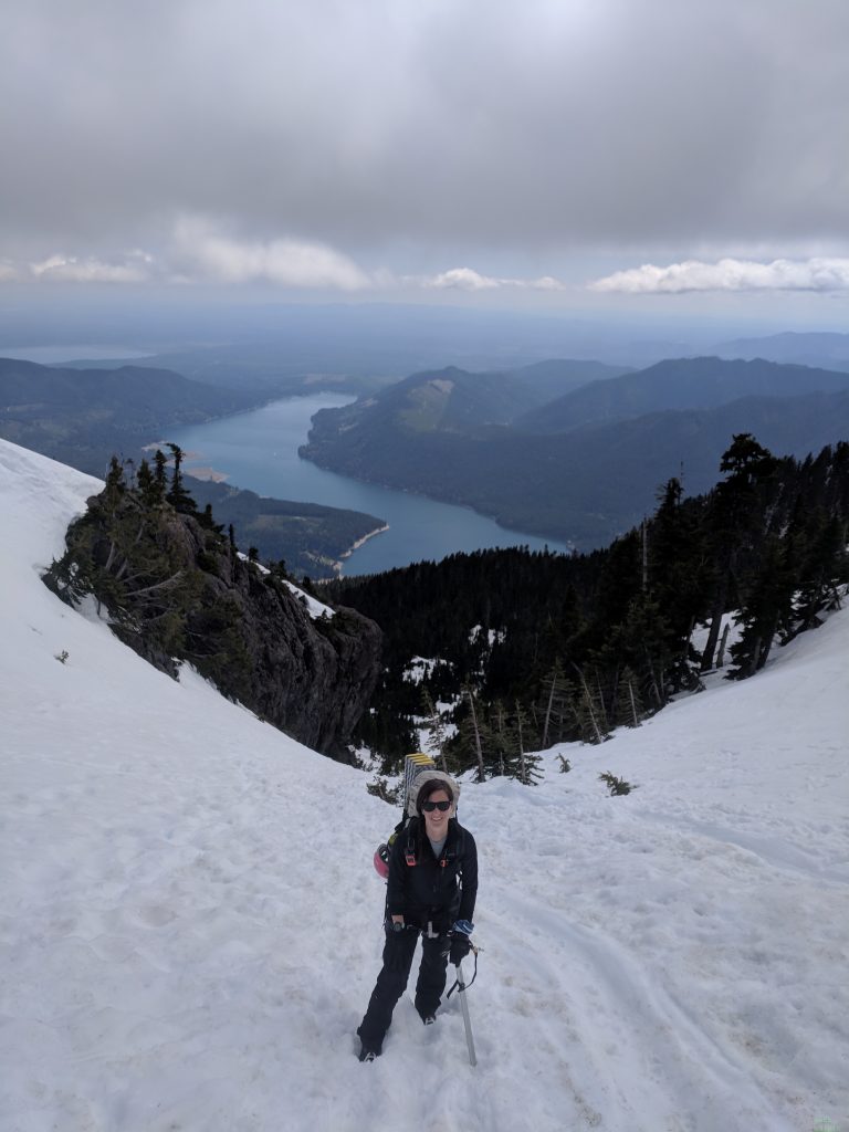
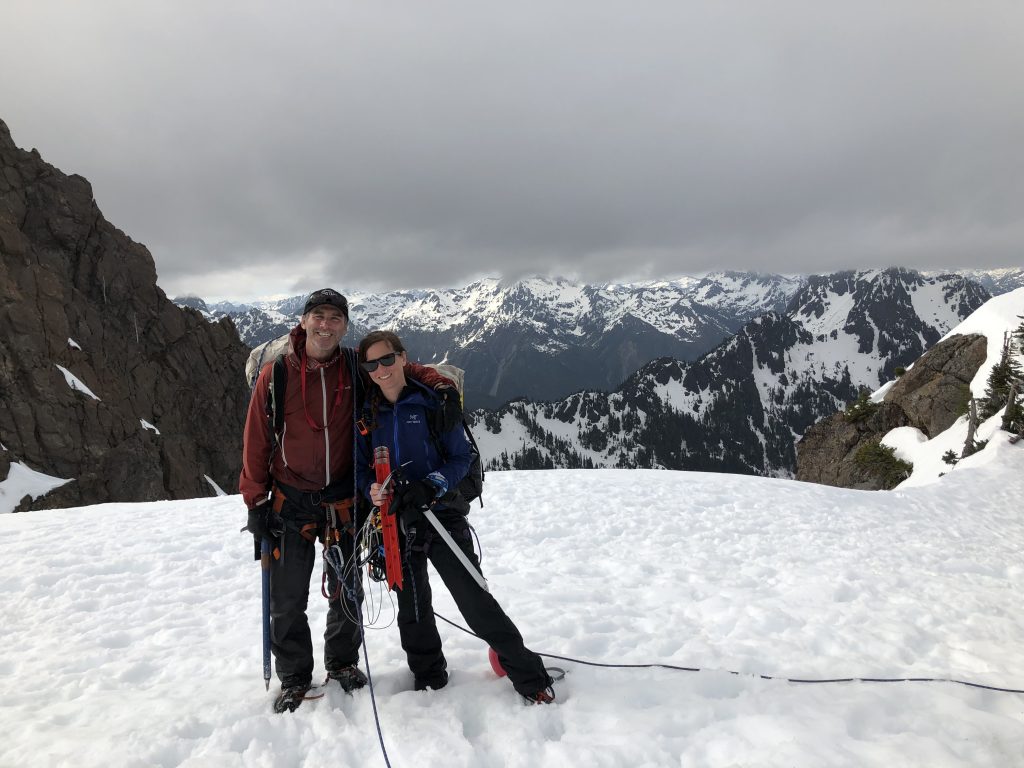
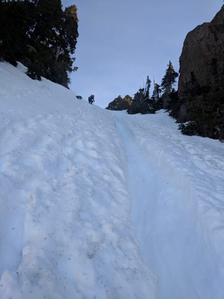
A Journey of Discovery in the Wild

Category: 40 Peaks for 40 Years (Page 1 of 2)

Confronting Fear on Peak 21: Tahoma

Peak 21: Tahoma (Mt. Rainier)

Elevation: 14,441’

Total Mileage: ~15

Elevation Gain: 9043’

Date: 26-28 July 2019

Introduction

The morning after my campus interview at the University of Washington Tacoma, in January of 2014, I pulled back the curtain of my hotel room to find an enormous, snowy volcano looming out the window. I gasped, breath caught in my throat. I had simply never seen anything like it. While I had visited Paradise the year before during a vacation, and saw the summit from Panorama Point, clouds had cloaked it throughout the rest of the trip. I never had that view of the mountain dominating the landscape. With such an impressive prominence (13,212’!!!), Tahoma rises significantly above the surrounding sea-level landscape. While many other mountains might be taller, Tahoma’s prominence lends it an awe-inspiring aura.

I never dreamed that I would actually stand on top of it.

For years, I told myself that I had no interest in climbing Mt. Rainier. I’m afraid of heights, have crippling vertigo, and simply never had the urge to catch the view from its summit. Nevertheless, the mountain held my imagination, and, to this day, I never cease to gasp when I catch a glimpse of it. I hope never to lose that sense of awe at its majesty. Perhaps I’m biased, but I think Tahoma is the most beautiful mountain in the world, and I deem it a privilege to live in its shadow.

As the mountains of the Pacific Northwest became my playground, occasional thoughts of summiting Tahoma crossed my mind, but never quite seriously. With some rock climbing and multi-pitch experience, the occasional thought grew to the faint tinges of an urge. By the time I started my 40 Peaks for 40 Years challenge, I knew that this summit had to be included. The prospect was equal parts thrilling and terrifying: the textbook definition of the sublime.

To prepare, I used other climbs (Loowit, Klickitat, and Ellinor, in particular) as training, and I took an Introduction to Crevasse Rescue course. It was important to me to come in as prepared as possible. Two friends, Harrison and Noel, would lead the climb and include a day of glacier school at base camp. I’m someone who likes to be fully prepared for any endeavor, to give myself a bit of reassurance that I can make it through. As summit day drew nearer, jitters set in, but the jitters-because-I’m-excited-jitters were still stronger than the jitters-because-I’m-terrified-jitters.

Paradise to Camp Muir

As I drove to my friend Jen’s house, the seat belt alert sounded the entire time. My pack, sitting shotgun, was so heavy that the sensors thought that it was a 49-pound human. It was incredible that I would soon be toting that thing up the side of a mountain. I had never carried anything remotely that heavy before, even on extended camping trips.

Embarking from Paradise with Jen.
Photo credit: Kind person at the Paradise Visitor Center

Setting out from Paradise, I staggered under the weight. It truly took my breath away to carry such a heavy pack. All we could do was laugh and keep going. Day hikers stopped us along the way to ask where we were heading and how much our packs weighed. They either told us we were strong and tough, or that we were nuts. One parent explained to their daughter what we were doing, and I thought how cool it would be if that image stuck with her and sent her into the mountains one day.

The trail to Pebble Creek.
Photo credit: Jen Schneider

We caught the rest of our party at Pebble Creek, where we turned off the regular trail and moved up the snow field below Camp Muir. I was growing accustomed to the small-human-sized load on my back, and the views of the Tatoosh Range, with Klickitat and Loowit beyond to the south and east, and Tahoma rising to our left, served as a nice distraction.
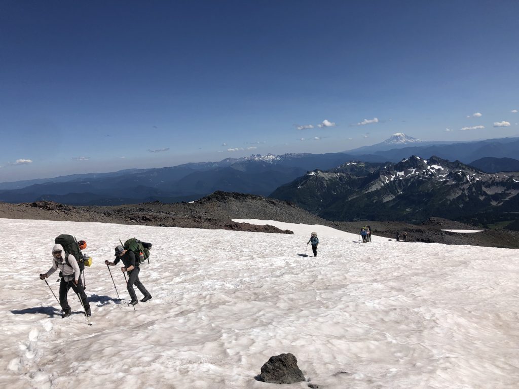
Up the Muir Snow Field. Klickitat in the distance.
Looking back at the Tatoosh Range to the south, with Klickitat in the distance on the left and Loowit on the right.
Continuing up the snowfield after a short snack break, with Tahoma looming as the backdrop. You can see a glissade chute to the left of the person on the bottom left.

Camp Muir comes into sight long before you reach it, and descriptions that suggest this makes for quite a tease on the long final slog are accurate. Of course, you’re too excited at this point to mind. Our permits allowed us to camp at Muir, so we scoped out options upon arrival and began the work of making camp in the snow. Harrison whispered the happy news to me and Jen that there was room in the climber’s hut. We didn’t think twice and giddily ran up to stake out a spot. We didn’t mind not getting the tent camping at base camp experience. The weather forecast for the night—strong sustained winds with serious gusts—was enough to convince us that we had no qualms about sleeping indoors. Plus, the climber’s hut has its own charms and sense of adventure.

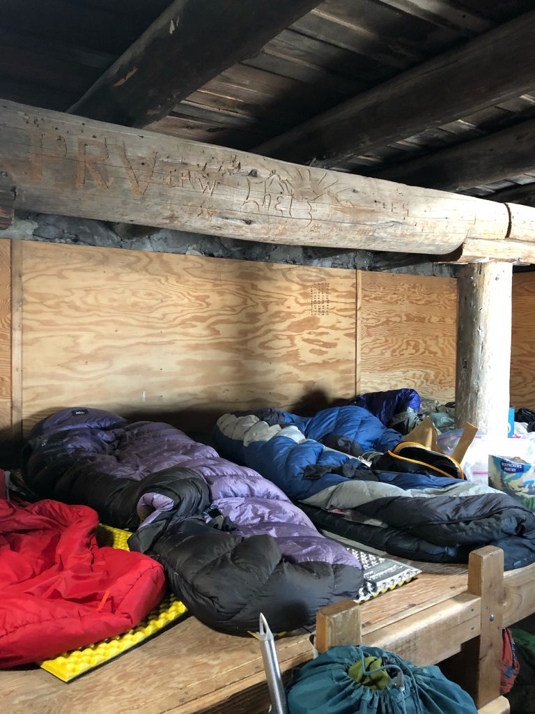
Ranger’s hut on the left, with the Climber’s hut on the right.
Shared sleeping platforms inside the hut.
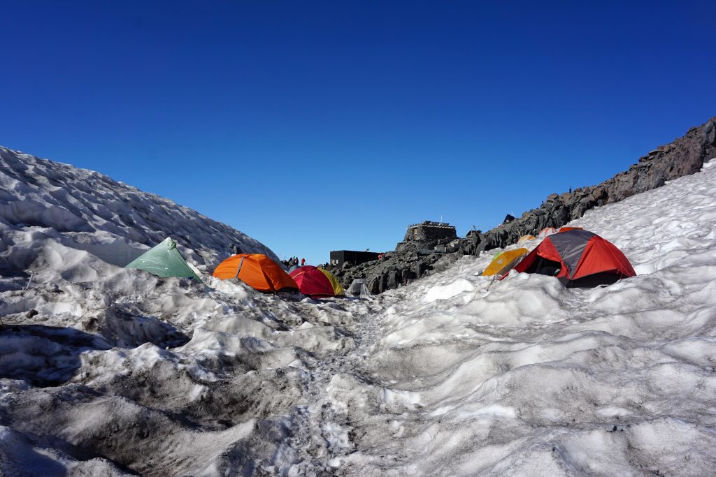
Team camp with hut in background. Photo Credit: Justin
Savoring the alpenglow, with Loowit in the distance.
Team camp, with the hut in the background. PC: Marie M.

Since we didn’t have much set-up time, Jen and I helped the rest of the team make camp and boil water. Harrison carved out a kitchen, complete with snow bench and table for preparing food and boiling snow. We would spend most of our free time boiling snow, as this is the only source of water at Camp Muir and above. After pitching in for team chores, we headed back to the hut for dinner and to get a good night’s rest. We’d need it. We mingled with other climbers in the hut for a while, and everyone turned in early, but not before marveling at the alpenglow that bathed the mountains in magic hour pink. At 10,080 feet, Camp Muir was the highest elevation at which I had ever slept.

Jitters Meter: Excited Jitters > Terrified Jitters

The wind raged that night, waking me occasionally and instilling gratitude for the relative comfort of the hut. In the dark hours of the night, a team of climbers stumbled in and quietly claimed a spot on the floor. I couldn’t imagine what their trek up from Paradise must have been like in this weather but was sure they must have felt sweet relief finally reaching the hut.  

Over the Snow Bridge and into the Crevasse: Or, Doubts Emerge

Harrison encouraged us to sleep late into the next morning, as we wouldn’t get much sleep Saturday night. After a lazy morning, we trekked down to our team’s camp to help with the daily chores. The climbing ranger on duty stopped by to update us on weather and mountain conditions. If this little pep talk was meant to instill sheer terror in us, mission accomplished. The ranger explained that the freezing line was coming down to a lower elevation that night, which would create dangerous “slide for life” conditions. “The ground will be too frozen for your ice axe to do any good, making it impossible for you or your rope team to self-arrest.” He conjured visions of us cascading off the side of the mountain, futilely trying to gain purchase in the ice with our axes, dragging our rope team helplessly along with us, and plummeting to our bloody death below. He didn’t mince words, and he made it sound like our chances of ending up in a slide for life scenario were quite high.

Jitters Meter: Terrified Jitters. Period. (Excited Jitters not strong enough to even faintly register on the scale.)

Pep talk completed, the ranger ambled off to share the great news with other teams. A silent but very palpable tension hovered between my team for what seemed like an eternity. Finally, I broke the tension in the only way I knew how, by making a joke of it: “Well, I’m terrified after that pep talk!” I said, laughing. Others nervously laughed and agreed. It felt good to know that I wasn’t the only one inwardly freaking out. I would say that I was figuratively shitting myself in that moment, but that metaphor is going to be much more apt a bit later in this narrative.

Harrison and Noel both reassured us that the ranger was just doing his due diligence by scaring us with the worst-case scenario, and that it was his job to remind us that we were undertaking a dangerous endeavor. Their calm cool and years of experience helped to quell some of our anxieties, but my nerves were definitely shaken. Doubts crept in, and thoughts of bailing began to form, but Noel and Harrison’s reassurances were enough to keep me committed to the climb. Noel explained that we would place pickets anyplace where a fall could prove fatal. It was enough to keep my fear at bay—at least far enough at bay that I wasn’t going to bail. With that, it was on to glacier school.

Harrison’s post-ranger-pep-talk pep talk. PC Jen S.

There’s nothing better for ensuring that your nerves continue to fray than to run across your first ice bridge. Noel demonstrated good crossing form, emphasizing the importance of building forward momentum and moving quickly. My brain simply could not compute that, and my body shook as I teetered across in the exact opposite way from what Noel had instructed. My nerves continued to unravel, but I worked hard to maintain a decent poker face.

Noel demonstrating how easy it is to run across a snow bridge. PC Jen S.

Finding a suitable slope, we practiced self-arrest from a few positions. I nailed the self-arrest but the ranger’s words echoed in my head, convincing me that my solid self-arrest skills wouldn’t matter in the slide for life conditions waiting above.

There’s nothing better for ensuring that your already frayed nerves continue to deteriorate than letting someone throw you into a (seemingly) bottomless crevasse. While I did take an intro crevasse rescue course, and I successfully hauled myself up and out during our practice runs, those practice runs were in a climbing gym, and the crevasse was just a bouldering wall.

I stalled by helping set up Z pulleys and hauling out the other brave souls. As each team member took a turn, my anxiety increased, knowing that soon it would be mine. Eventually, I turned to Harrison and said in a lowered voice, “Harrison, my nerves are just completely shot. I can’t do it. I just can’t do it.” In his characteristic calm and reassuring tone, Harrison said, “No problem. Do what you’re comfortable with.” As the last team member who wanted to go in emerged from the crevasse, I had a change of heart. Or, perhaps more appropriately, my ego kicked in. I wasn’t going to wimp out.

“OK Harrison, lower me down.”

Alright!!!”

Crawling to the edge of the precipice, another team member, Travis, gave me a safe word: “When you’re ready to come out, just say ‘Unicorn.’” The team lowered me into the abyss. When being lowered into a seemingly bottomless crevasse, it’s important not to look down, especially if you’re terrified of heights and your nerves are already frayed. As soon as I was over the edge, I looked down. It was the scariest sight thine eyes hath ever beheld. The walls of snow were tinged with blue, and my eyes traced them down as far as I could see before it dissolved to black nothingness. There was no visible bottom, just who knows how many hundreds of empty feet in the void below. I crammed my crampons into the side of the crevasse.

“Unicorn! Unicorn!! Unicooooornnnn!!!”

Harrison crawled out to check on me while Travis laughed, hanging over the edge and snapping photographic evidence that I really did allow myself to be lowered into a crevasse.

“Hey girl! How’s it goin’ down there?”

“Harrison, this is awful!” I laughed but was serious.

“OK, you’ll have to hang out for a few minutes while we get things set to haul you out.”

I morbidly looked down again. And again. I couldn’t help it. My brain couldn’t fully process the bottomlessness. While I had wanted to practice my self-rescue skills, I was too far gone to do so now. It’s one thing when you’re in a gym. Hanging above oblivion is quite another matter. I reassured myself that, if I actually fell into a crevasse, that I would be capable of getting myself out. Knowing that there was a team set up to pull me out now, though, zapped any motivation for practicing my self-rescue skills.
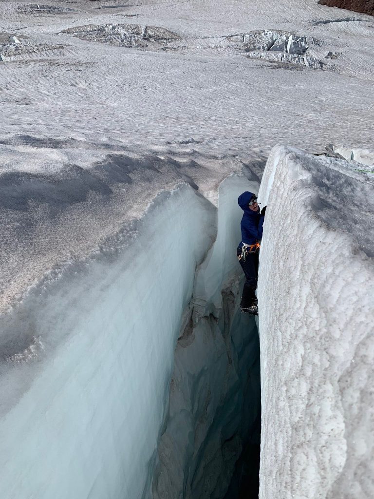
“Unicorn!” I’m smiling because the team is pulling me up. PC Travis

I heard voices shouting instructions, which Travis relayed: “OK, you’re going to drop a bit at first before they can pull you out.” I knew this was coming, having helped haul others out, but being on the other end of the rope put the matter in a different light. That drop felt like a giant lurch down into the gaping maw of the crevasse. Finally, the tension on the rope tightened, and I slowly ascended to the lip. It was a matter of seconds but felt like hours. Collapsing into safety, Harrison crawled over and slapped my leg with excitement. Everyone was laughing, because they could appreciate just how scared I’d been. Exasperated, I laughed and asked, “Why did I look down?! As soon as I got in, I looked down!”

She emerges from the abyss. VC: Travis

Calling it a day, we traversed back across the snow bridge and began making preparations for our summit bid. Harrison and Noel walked us through the plan. At one point, Noel mentioned that there would be some places that it would be too dangerous to take time to place pickets, because the danger of rockfall far outweighed the danger of a potential fall. My face must surely have blanched.

“How do we get through those sections safely, then?” I ventured.

Looking me dead in the eye, Noel explain, “In those places, you just can’t fall, Ellen.”

[Terror meter broken.]

I spiraled. We adjourned to eat an early dinner so that we could try to be in bed by 7:00 p.m. We’d be meeting up at 11:00 p.m. to get roped up and start our ascent by midnight. That evening was a blur at best. I don’t remember eating or talking. I just recall being gripped by thoughts of useless ice axes and replayed a looped video of myself sliding off the mountain. I wondered if I would scream as I slid, ice axe as useful as a donut in my hands, or if I would silently fall away over the edge.

By the time that I crawled into my sleeping bag, I decided to abort. I was convinced that the conditions were too dangerous, and that my chances of dying were larger than I’d accept. Reaching the summit wasn’t worth it. The possibility of dying on the mountain struck me as very real and very possible. I participate in risky endeavors, but I do my best to mitigate risk, and I don’t do things where I feel that my chance of dying outweighs my chance of survival. The ranger’s words, coupled with Noel’s hardly reassuring suggestion to “just don’t fall” were enough to send me over the edge. I was bailing on the climb, and I was just fine with it. A small sense of relief overtook me, calming me a bit, giving comfort in knowing that I wasn’t going to have to go up the mountain.

Summit Day

When our alarms went off, I went through the motion of getting dressed and eating breakfast. I loaded my pack as if I was climbing, but I had no intention to follow through. When I got to camp, everyone was getting tied into their ropes. I told Harrison and Noel that I just couldn’t do it. I was too scared and it didn’t seem worth it. They tread a fine line between trying to reassure me, while also letting me know that they wouldn’t force me to go.

“I don’t want to rope up, then get part way up and not be able to make it. I don’t want to ruin the rest of my rope team’s climb.”

“If you get up there and want to turn back, at any point, I will cut the rope and bring you down myself,” Noel offered. It was reassuring, but I would perhaps endanger the rest of the team by taking away one of our two experienced leaders.

I’m the figure in the center of the photo, and clearly the only person not tied into a rope. PC Justin E.

Everyone was roped and ready, and Harrison was doing some final checks. Without skipping a beat, he said, “Jen, I need you to take this extra water in your pack. Ellen, I need you to get tied into this rope. Justin, I need you to…” There was something in the way that Harrison said it, so matter of fact, so calm and collected, yet also like someone in charge whose orders you’re supposed to follow without protest, that I found myself tying into the rope. Within minutes, we were off.

Camp Muir to Disappointment Cleaver

We would follow the most traveled, and probably easiest, route up the mountain: the Disappointment Cleaver route. (Here’s a cool video overview of the route.)

The Disappointment Cleaver (DC) Route. PC: Travis

Heading out of camp, we passed under a wall of rock that would prove increasingly more dangerous as the day warmed, and even at night, we wouldn’t be able to stop through this section. In fact, we would need to move through it as quickly as possible to mitigate any risk of rockfall (rockfall being the most dangerous aspect of the DC route.) The large boulders strew about the side of the worn path in the snow served as a reminder of this risk as we moved briskly through this section.

View of route across the Cowlitz Glacier and up to Cathedral Gap. We would traverse this in the dark that night.

We traversed across the Cowlitz Glacier and up the pass to Cathedral Gap and Cathedral Rocks Ridge. Switchbacking up to the pass on dreaded scree, I kept my head down and focused on Noel’s heels in front of me. As we neared the top, two women came flying past us: it was Kaitlyn and Alex, working on their second summit of their Infinity Loop (climbing up to the summit, going down the other side, running half of the Wonderland Trail around the mountain, summiting again, going down the other side, and running the other half of the Wonderland. Wow.) I felt so impressed and humbled by them, but I reminded myself that it took all I had just to be going up once.

We took a brief break at the top of Cathedral Gap, and Noel checked in with me. He said, “Let’s just get to the next break stop, and we’ll assess from there and decide whether or not to turn back.” Having a small goal helped me to move forward. I wasn’t climbing to the top; I just had to get to the next rest stop. From there, we traversed the Ingraham Glacier past Ingraham Flats, which serves as a high camp along the DC route. Pins of light punctuated the curtain of darkness, as climbers zig-zagged up the mountain ahead of us. That’s one image that will remain forever etched in my inward eye.

We weren’t the fastest group on the mountain, and others overtook us. This included guides short roping their clients up. It was a little surreal to see these burly mountain guides dragging their clients up behind them. I’m certainly not in a position to judge, but the clients struck me as just having to hang on for the ride while the guide pulled them up. My team leader was very much responsible for mentally pulling me up the mountain, but I was glad that at least my body was doing all of the physical part.

As we traversed toward the foot of the Cleaver, a wall rose to our left; we followed a narrow foot path, and there was a drop to our right. Fortunately, it was pitch black, and I couldn’t see what lay below. I kept my headlight trained on the ground in front of me, focusing both my mind and eyes on the tiny circle of light in front of me. Breaking my trance, Noel called back, “Here’s our first crevasse. Ellen, just build up momentum and jump over it.”

Instead, I stopped dead in my tracks, digging in my heels and refusing, like a mule. Eff that. No way. There’s an enormous (to me) gap in the ground that drops into oblivion, and I’m not taking another step. No way. Nope.

“I can’t do it Noel. I can’t. I just can’t do it!” The panic in my voice made it unrecognizable to me, like it was someone else talking.

“One, two, three, go!” He tried.

Nope.

“One, two, three, go!”

Nope.

And then, inexplicably, I leapt. I don’t know how to explain what happened other than to say that for a brief moment, my brain compelled my body to move, and then my brain shut off so as to foreclose any counterarguments.

I’ll quit with the jitters meter and just say that my jitters were off the charts for the entire ascent. Never in my life have I been so terrified, and never have I been terrified for such a long and sustained period of time. This made my 5-pitch climb up Cat in The Hat at Red Rocks seem like a breeze. Every step was agonizing. I couldn’t imagine having to leap more crevasses along the way. I couldn’t fathom even making it to the next rest stop. I wanted to turn around and felt a leaden dread with each step forward. This was, without question, Type 3 Fun (that is, something that isn’t fun, ever; not even in hindsight.) I would never, and I mean never, do something like this ever again. That phrase looped through my mind for the duration of the ascent.  

When we reached the foot of Disappointment Cleaver, I was exhausted from the emotional toll of the climb. I was ready to quit, but Noel once again said, “OK, let’s just get to the top of the Cleaver, and then we’ll reassess. Just get there, and we’ll decide if we keep going or not.” It’s the sign of a good leader when someone, with a few simple words, can convince you to push past that which feels insurmountable. I agreed to keep going.

Then, he added, “Now, Ellen, there are a few places through here that are some of those ‘just don’t fall’ spots, so, don’t fall.”

I had already committed to going forward, so it didn’t matter how terribly those words rang in my ear. While I had been shitting myself figuratively up to this juncture, I now also had to refrain from literally shitting myself in fear. It is the first time in my life that I fully understood the source of that phrase. In addition to fighting the fear gripping every part of my being, I also had to scrounge every last shred of will and energy to avoid pooping my pants while tied on a rope connected to four other adult humans.

As we unroped to navigate the Cleaver, which becomes a rock scramble, Harrison took a celebratory moment to congratulate us: “You made it through what everyone says is the scariest part! Nice work, Team!” I tried to find comfort in that but had to make a big effort not to allow myself to dwell on the fact that we would have to go back through there again on the descent—and at that point, we would actually be able to see what was so scary about that section.

Scrambling up the Cleaver, I worked hard to keep up with Noel. I wanted to follow his footsteps and take the best path up through the rocks. He moved much faster than I typically would while scrambling, so it was a delicate balance of trying not to go uncomfortably fast while also not getting dropped behind. Occasionally, he would pause and say, “OK, Ellen, this is one of those ‘don’t fall’ spots. Just keep to the left, and don’t look down to the right.” Those words would send my nerves spiraling, but the only way was forward. Again, it was too dark to see what awaited if I went too far right, but I assumed it involved a very long drop down. After hearing this directive a few times, I started to wonder if ignorance might truly be bliss, and perhaps it would be best for Noel not to tell me “just don’t fall here.”

Ascending the Upper Mountain, One Snack Break at a Time

Cresting the top of the DC, we walked over to a flattish rocky area for a break. I felt completely frazzled and at my wit’s end. Noel and Harrison both came over to talk to me. Tears rolled down my face. “I’m just so scared, guys. I’m so scared. Every step is painful and takes everything I have to go forward.”

Trying to be helpful, Jen said, “What are you so afraid of?”

“Dying.”

“Why are you afraid of dying? It will be over quickly and then you’ll just be dead!” She said, laughing nonchalantly.

“Because I have too much to live for, and too many things left to do in my life!” I returned, anger rising in my voice. She realized her pep talk wasn’t helping, as my agitation grew.

“Look up there,” Harrison said, gesturing to the upper mountain. We can see the rest of the route from here. It’s just switchbacking up snow the whole way. Easy peasy. The hard part is over now.” Tears paused; my heart rate came a little more under control. I guess it didn’t look so bad from here.

Coming up the Cleaver, moon overhead and sunrise behind. PC Justin
Cresting the Cleaver, Little Tahoma below. PC Marie
Looking down from the top of DC. PC Marie
Reaching a rest stop after navigating the DC. PC: Marie

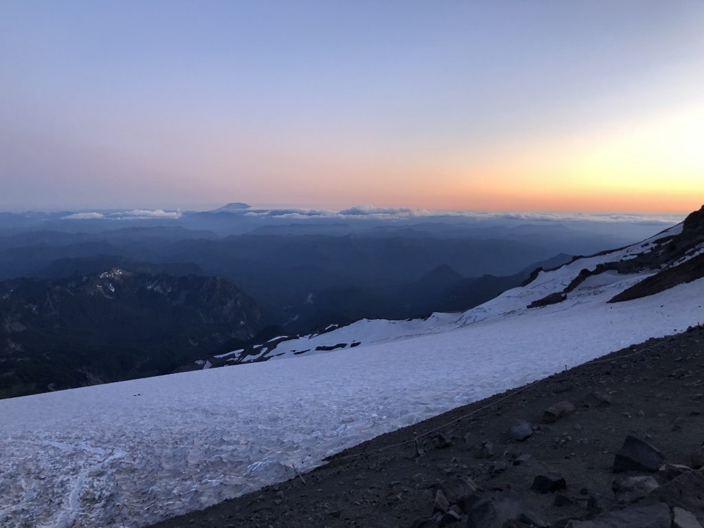
We took a snack break and watched the sun rise. Below, Little Tahoma stood like a spire, but it also seemed so tiny compared to the massive mountain on which we stood. My thoughts raced. I didn’t want to quit, but I was sincerely terrified of continuing. For good or for ill, my ego can be quite strong. In the end, it’s the main thing that prevented me from turning around. While the reassurances and support were key, when it came down to it, my irrational fear of failure and distaste for quitting are what ultimately convinced me to stick with it. I sensed that I would never forgive myself for quitting, strong as my fear was. Perhaps this is a character flaw, but I also knew that Harrison and Noel wouldn’t be taking us up here if they thought we wouldn’t be coming back. Of course, accidents can, and do, happen, but they felt the conditions were as safe as they were going to be (and the freezing line had not come down as low as the ranger had predicted).

In that moment, I decided to stop letting fear get the best of me. I had committed to the climb when I roped up, and I had to get myself together and carry on with confidence. Being deathly afraid wasn’t making the endeavor any easier, so I would simply will myself to be stronger.

Dawn breaks.
Dawn above Little Tahoma. PC: Jen S.
Made it to the next rest stop. PC: Justin E.

As the morning light illuminated the route, Harrison continued to express how pleased he was with the conditions. “Guys, this is going to be a great day to summit. These conditions are absolutely perfect. I have never, in all the times I’ve been up here, seen the route in such great condition. Usually we have to go way out of the way to switchback around crevasses, but this route is as direct as it gets.” Now that I think of it, I have no idea if he was actually telling the truth. In the moment, it didn’t matter. I believed him and tied back into the rope.

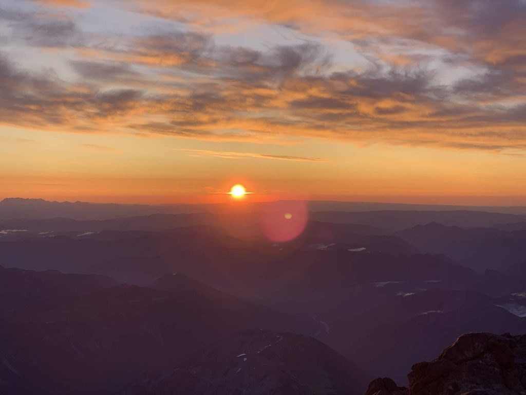
The sunrise swims on the horizon. PC: Angela
Morning light on the upper mountain. PC: Angela
Resting up for the next leg. You can see a team on the upper mountain in the distance. PC: Marie
Sundance. PC: Travis
Sunlight meets glacier. PC: Cole

Overall, the upper mountain wasn’t terribly bad. There are some steep, exposed slopes, but I kept my eyes on the path in front of me, ice axe ready, careful with each foot placement to dig my crampons into the hard snow. We leaped a few crevasses, sometimes going uphill, but I only paused momentarily instead of digging in heels. There was one very exposed and very steep section where others had clearly placed pickets. It was clearly a newer route, as the alternative was to negotiate a large crevasse that was apparently opening wider as the season went on. There wasn’t a great foot path here yet, and your feet were essentially at an uncomfortable angle. Of course, this was better than trying to get over the large crevasse, but it was one of the scarier sections. Once on the other side, I asked Noel why we didn’t use pickets there. “We will on the way back, for sure.”

Ascending the upper mountain. PC: Marie
Following the route up the upper mountain. PC: Justin
Taking a break in a precarious place. PC: Marie

We paused for one final snack break, perched precariously on the steep slope. Other teams had already summited and were making their way down. It was then that I realized that we were one of the last groups still ascending. We were, admittedly, probably the largest group (with 14 people), and our team ranged widely in fitness levels and experience. Since the day was slowly growing warmer, and conditions would become less ideal as a result, we didn’t linger long here.

Waiting while the team ahead of us jumps the crevasse. PC: Jen S.
Who is this smiling person? PC: Justin E.
Who’s crying now? PC: Justin E.
Oh, just a little crevasse to jump uphill. No big deal. PC: Jen S.

Shortly after this, we reached the vertical ladder we’d heard about. It served to bridge a widening vertical gap. Noel went up first to make sure it was secure, and the rest of us were prepared to arrest if necessary. I was next. For some reason, the vertical ladder didn’t scare me. Later, Noel would tell me that this should have been the thing to scare me, as it was one of the most dangers parts of the climb. Good thing he didn’t mention that before I placed my foot on the first rung.

The ladder. Doesn’t look scary, does it? PC: Travis

From there, it was mostly just switchbacks to the top. While still a tad anxious, my fear had largely subsided by this point. I could tell that my pace had slowed and my breathing became shallower. While I didn’t have any major warning signs of altitude sickness, I could feel the elevation and sensed that it was responsible for me feeling tired. Reaching the crater rim at long last, we had one final challenge: not falling into the gap that rings the crater rim. Hot air rising from the molten belly of this stratovolcano weakens the snow around the crater’s edge. You have to make one last flying leap from rock to the inner crater to avoid dropping down through warmed snow hiding the empty space below.

The Crater Rim and Summit

This wouldn’t be an honest report if I didn’t admit that the very first thing that I did upon reaching the crater was not a dance of joy, not a sigh of relief, not a round of high-fives with my teammates. No, the first thing I did was pull out a blue bag, run as far from the people assembled around the crater as possible without getting too near the edge, situate my pack as the best shield I could engineer, and, well, you know what blue bags are for, right? I was simultaneously humiliated and relieved. I’ve never gone to see a man about a horse so publicly in my life, so that was mortifying, but I’d used every scrap of will power not to shit myself on the ascent, so this felt like a tiny victory in comparison.

View of path across the crater from the summit register rock. PC: Marie M.

Meeting adjourned, I made the trek across the floor of the crater to gain the actual summit, which is still another quarter mile or so away. Partway up that last rocky climb, there’s a summit register. I wrote, “Thank you, Tahoma,” and signed my name. From there, it was just another minute to the true summit, known as Columbia Crest (the two other named peaks on the summit include Point Success, at 14,158’, and Liberty Cap, at 14,112’.)

As I walked onto the true summit, a hot surge of emotion overwhelmed my entire being. I sobbed, but this time with joy. My body shook, overcome. Two teammates, Angela and Kevin, walked over to me. “I never thought I would be here,” I said in a warbled voice through tears. “I never thought I could do something like this.”

Kevin smiled and said, “I can’t believe you made it. I thought for sure you would quit. I can’t believe you kept going, because I could see how scared you were. Can I give you a hug?” I smiled and went in for a hug. It hadn’t occurred to me that others could see how scared I had been. It was, honestly, quite embarrassing to hear someone say they didn’t think I could do it, but Kevin’s words also made it feel like he recognized what I’d had to push through to get myself there, and that he saw this in a positive light. Maybe I could try to look at it from his perspective.

I asked them to snap a summit photo for me. Forgoing the standard ice axe held overhead in triumph pose, I dropped to my knees and folded my hands in a prayer of thanks to the mountain.

Grateful on the summit. PC: Angela
Happy summit. PC: Angela

We lingered on the summit for some time, dancing, laughing, high-fiving, posing for photos, passing around a can of Rainier beer.

Celebrating with Noel.
PC: Angela
Celebrating with Harrison and Kongie.
PC: Angela
Obligatory summit selfie, with Noel and Angela.
PC: Angela
Yay Team!
PC: Travis

Stepping away from the team, I took the opportunity to look out in all directions and contemplated the view. The Cascades unfolded in all directions, and the other local volcanoes were in full view. Rivers, which emerge from snow and ice on the flanks of this mountain, meandered far below, making their journey to the Salish Sea. Scanning the valleys and waters below, my eyes sought one particular landmark: Tacoma.

For years, I have looked up at the mountain from below. I see it almost every day from my vantage point in Tacoma. Now, here I was, standing on top of it. I wanted the reverse view. Working my way along the Sound, my eyes made out the city for which I’d been searching. There it was, Tacoma. I was looking back at the place from which I typically stared up at the mountain. I sank to my knees and stared in wonder, smile pressed firmly across my face. I heard Noel whisper, “Let’s give Ellen some alone time on the summit.” The team made their jolly way back down to the crater, leaving me the sole human on the highest point in Washington.

How to capture my thoughts in that time? Perhaps it’s better described as a feeling than thoughts. A profound sense of accomplishment filled me, mixed with the thrill of being on top of this mountain, of having done something I never thought possible for me, and, above all, a feeling of gratitude for the privileged life I live and for the mountain allowing me to stand there. I kept whispering, “thank you, thank you.” It was all I could say. I stared down at Tacoma and the bustling world below and gave thanks with each breath.

Looking down at Tacoma from Tahoma. PC: Austen K.

As Seth always reminds me, “Going up is optional; coming down is mandatory.” We’d arrived at the crater around 9:30 a.m. and it was now going on 11:00. The sun was shining and the skies were blue, but this also meant that the snow was softening and the route would be at its most dangerous. We were one of the final parties left on the crater that day, which was a clear sign that we needed to start making our way down. With some urgency in his voice, Noel said, “We’ll need to pick up our pace on the way down.”

Before we departed, one team member came up to me and said, strong emotion audible in his voice, “Thanks for not quitting. It’s the only reason I didn’t quit. I told myself, if she can do it and she’s that scared, then I can’t back out. Because of you, I was able to make it to the top. Thank you.” It made me feel good to hear this, to know that I wasn’t alone in being scared. It also made me think differently about being vulnerable and showing my fear. By the end of the excursion, three additional teammates would tell me something along the same lines, that they only kept going because I did. One even mentioned that he was hoping I would quit so that he didn’t have to be the one to initiate quitting. In the end, he was glad that I stubbornly went on, not giving him an excuse to stop.

I try so hard to be tough, someone who fearlessly charges into the wild and shrugs off tough pushes. Crying and outwardly acknowledging my fear to a group of relative strangers is not my M.O. What this experience was showing me was that there is some value in admitting when you’re afraid. It’s something others can relate to, and perhaps your determination to push forward can help them to do the same. Outdoor adventures never cease to offer me life lessons, always challenging me to continue to grow. This was clearly no exception.

The Jogging Descent

Following Noel’s cue, we trotted down the mountain. The snow had turned from icy to slushy, giving crampons and ice axes less purchase. My fear had largely abated, and I wanted to get down as quickly as possible, understanding that the danger of rockfall increased along with the mercury. Noel laughed when we reached the first crevasse and I expertly, and with no hesitation, leaped over it. “Wow, look at you now” he cheered. It was a little easier to get over them going downhill, but I was also at a point where the urgency to get down was more compelling than my fear of falling into a crevasse.
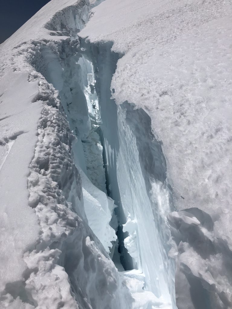
Meh.
PC: Jen S.

Reaching the vertical ladder, Noel crept down to make sure that it was still stable enough to come down. The anchors were solid enough, which was a good thing, because I have no idea what Plan B would have been. I was the first one down. At the bottom, there was a fixed rope, which I anchored into while waiting for Noel to coach down the rest of our rope team. I stood on a narrow bridge between two gaping crevasses. There was a short wall of snow on one side, which I leaned over and stared into the blue abyss. Water droplets trickled from the melting snow, echoing in the hollow void. Strangely, I felt at ease, and was able to take in the impressive sight, marveling at its beauty and its quiet danger. That will remain one of my favorite impressions from this adventure.

Quick break before going down the Cleaver, looking back at where we came. You can see Harrison’s team descending.

As we arrived at the top of Disappointment Cleaver, we opted to remove our crampons for this rocky section. I find the downclimbing part of rock scrambling much more difficult than going up (which I think is pretty common), plus, now the daylight revealed the exposure along some stretches, and I could see how far down I would plummet in the “just don’t fall” parts. One team member, Travis, kindly helped me negotiate the downclimb, pointing out the best path and steps to take along the way.

Descending the Cleaver, Little Tahoma rising like a spire. PC: Angela

Regrouping at the foot of the Cleaver, we roped up and donned crampons again. We had reached the section that is apparently the scariest, and now I could plainly see why. We traversed along the edge of a cliff. To our right, was a wall of snow. To our left, was a sharp drop down to a glacier so heavily crevassed that my mind couldn’t process what my eyes took in. It was a sea of ice and snow, the crevasses like tidal waves. I had never seen anything like it. Similar to my experience in the crevasse the day before, in which I couldn’t help but look down, now I couldn’t peel my eyes away from this remarkable, albeit frightening, sight. It was quintessentially sublime.

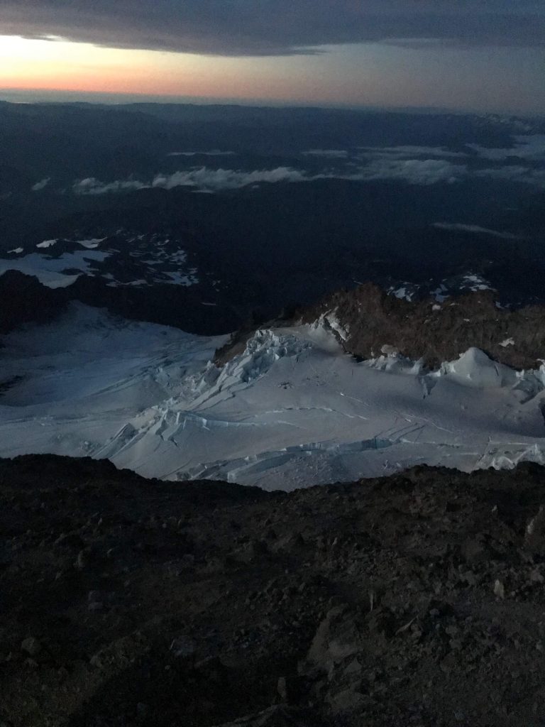
Ingraham Flats high camp, seen from above, surrounded by a sea of crevasses. PC: Angela

We reached what Noel informed us was the most dangerous section of the route. Rockfall could be deadly here, so we needed to get through as quickly as possible. We waited at a relatively safe distance as Harrison’s rope team prepared to go through. Noel grew anxious as they lingered in a vulnerable position instead of making haste. He turned to us and said, “We are not stopping through there. We’re going to move through it as quickly as possible, with no stopping.” The tone of his voice conveyed the seriousness of the situation. According to Noel, this was one of the deadliest spots on the mountain. Fortunately, he told us this after we’d passed through, having given us only enough information as was necessary to reinforce that we couldn’t mess around here. After Harrison’s team was through, we quickly followed.

By the time we reached Ingraham Flats, we were jogging at a good clip. Coming down through Cathedral Gap, I slid on scree in my best imitation of scree dancing. We had one final sketchy section to negotiate, where once again rockfall was a concern. With that final push, we found ourselves back at Camp Muir. For the first time since I tied into that rope, the tension in my muscles fully relaxed.

This Way to Paradise

Our day wasn’t finished yet, though, as we still had to break camp and get back to Paradise. Fortunately, there were some great glissade chutes on the snow field, which saved a lot of time on the way down. Reaching Pebble Creek, Harrison stood sentinel, making sure everyone got down. Our team had spread out, and I linked up with Justin and Dan as we made our way down to Paradise. I was still wearing a rented pair of plastic mountaineering boots, regretting that I hadn’t opted for a little extra weight and carried approach shoes.

In our fatigue and the fallen night, we took a wrong turn, and ended up going the wrong direction on the Skyline Trail. I realized our mistake when the lights of Paradise came into view, but from the wrong direction. Fortunately, I had the map downloaded on my phone and had imported GPX tracks for the route, which I used to get us going back in the right direction. While I had been the scared, crying woman on the mountain, I was now in my wheelhouse and was glad that I at least knew how to navigate us out of there.

At this point, we were toast and had very little left to give. Justin tried to make small talk to distract us, but Dan and I could hardly reply. I had an iron focus on getting down to Paradise and out of these boots. When snow gave way to pavement, we picked up the best run we could manage. I wouldn’t let myself imagine what my feet were going to look like. At long last, we trotted into Paradise, where some other team members were waiting.

Jen was still on the mountain, helping a struggling team member to get down, so I put on all my layers and waited on the picnic table. Shivering, I climbed into my sleeping bag, too. I must have been a little out of it, because I didn’t realize that the table was soaking wet, and the moisture soaked through the sleeping bag as well as all of my clothes. Noel pulled up, and I climbed into his car with the heat blasting, trying to warm up. Jen was still up there, and everyone else was heading to Seattle. Had I been dry, I would have curled up next to her car and slept until she got down. Being soaked through and shivering, though, all I wanted was to stay warm. This long and taxing day just wasn’t through with me yet, it seemed.

In an odd coincidence, some climbers I’d met in the hut at Camp Muir pulled up looking for their friend, who was with Jen. They had to get back to Tacoma and were concerned about him. Reassuring them he was fine and that Jen would bring him home (somehow, Seth was able to deliver messages between me and Jen, although she and I couldn’t reach each other), I asked if they could give me a lift to Tacoma. They were more or less strangers, but they were so concerned about their own friend’s safety that I convinced myself they were good people who wouldn’t murder me. Noel reluctantly let me leave with them, and I assured him that they were ok.

Turns out, they were both very nice. We chatted to keep the driver awake, but we were all exhausted, and it took a lot of effort. I pulled the plastic boots off for sweet relief; my feet swelled terrible, but there was no way that I was putting those things back on. We pulled in front of my house around 3:00 a.m. and, barefoot, I dragged myself inside for some hard-earned sleep.

Reflections

Climbing Tahoma was one of the most challenging experiences of my life. Like rock climbing and rappelling, I find mountaineering scary. I’m afraid of heights and have trouble with vertigo. It’s all very firmly Type 2 Fun. It’s really never Type 1 Fun, fun in the moment. Climbing and mountaineering don’t come naturally or easily to me; they take a lot of hard work, both mentally and physically. They require that I dig quite deep and push myself beyond my perceived limits and certainly out of my comfort zone. As much as I love to run, it doesn’t challenge me in this way.

And, yet, for some strange reason, I keep doing these things. They don’t bring the instant pleasure of a great ridge run or gnarly bushwhack, but they must provide something I need, or want, because before I went to sleep that night, I thought to myself, “I wonder what other climbs Harrison and Noel might lead next?”

Perhaps, in the end, I seek a means for breaking through a wall of fear. I don’t want fear to hold me back, whether that’s in taking a leap across a crevasse, or taking a figurative leap and starting a new life. Maybe rock climbing and mountaineering aren’t necessarily fun-fun, but they do embolden me in ways I’ve never thought possible. Turning 40, the inciting incident that led me to climb Rainier in the first place, forced me to reflect on what I have done with my life so far. I haven’t accomplished all that I’d hoped, or dreamed, and I feel a sense of urgency to make the second half of my life better, and more fulfilling, than the first half. Maybe forcing myself to confront my fears in nature will give me the strength to tackle the daunting prospect of starting a new life. Like jumping over a gaping maw in the snow, it’s frightening in the moment, and it’s hard to take that leap, but it’s quite a thrill once you get yourself to the other side. And, if you don’t quite clear the gap, then you can take comfort in knowing that you have a team there ready to catch you, and to help you pull yourself out from the void.

Many thanks to everyone who made this experience possible. To Harrison for putting together a great team and managing most of the logistics; to Noel for his guidance and support and for getting me up that mountain one rest break at a time; to my teammates for sharing the experience with me, and for providing many of the photos used here; to those guys who drove me home in the middle of the night despite my stinking feet; to my climbing partners, Terry, Charles, and Jim, for coaching me into a better rock climber; and to Seth, for helping me practice my mountaineering skills, teaching me how to self-arrest, and letting me borrow much of the gear that I schlepped up the mountain. Finally, thanks to the mountain itself, for everything.

Can you see me up there? Seth took this photo about 2 hours before I reached the summit.
Photo credit: Seth Wolpin

Peaks 19 & 20: Thomas and Thorp Mountains (Plus Needles 50k Race Report)

Peaks 19 and 20: Thomas Mountain and Thorp Mountain

Elevation: 5269’ (Thomas) and 5854’ (Thorp)

Total Mileage: 32.36 miles

Total Elevation Gain: +10,169’

Date: 6 July 2019

My friend Rich maintains that his Needles 50k is “more fun than laughing.” Crossing the finish line for the first time in 2018, I understood exactly what he meant. It’s a tough, tough course, but it’s so gorgeous, and the vibe is completely chill and goofy and full of good mirth. It’s easily one of my favorite race experiences, and this year proved no different.

Somehow, I convinced my friend Jen that running two consecutive, challenging 50ks was a good idea. We pulled into the large horse pasture at the Silver Ridge Ranch, which serves as race headquarters. I pitched a tent and fell asleep to the sound of the stream rippling by.

There are no bibs, no chips, no numbers at Needles. After a course briefing, Rich and Adam sent us out along the airstrip and into the woods. The trails start off friendly enough, but things get steep real quick. That first climb never ceases to crack me up. It’s just relentless to the point of absurdity. Fortunately, you have time to take in the mountain views that unfold around you on the ascent, with Cle Elum Lake deep blue below.

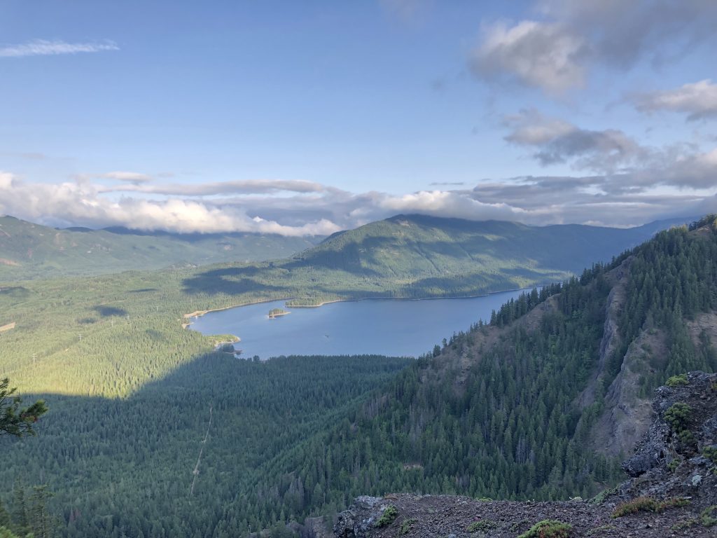
A gorgeous day dawns over Cle Elum Lake.
Hard-earned views of Cle Elum Lake.

Intent of tagging all peaks within striking distance that summer, we briefly detoured at Thomas Mountain. The summit itself is rather underwhelming, with no real views given the surrounding trees. Seeing a pile of rocks, I stepped on top and guessed that was the highest point, which we paused to confirm on the map. I didn’t climb all those switchbacks just to have Rich deduct another poo poo point from my 40 peaks goal.

We’ll call this rock pile the summit (but will confirm on the map!)
Photo credit: Jen Schneider

All that climbing pays off with a long, fun descent. We linked up with Brad, who was also doing a milestone challenge: 50 ultras for 50 years. If I remember correctly, Needles was #25, so he and I were both halfway to our goals. I think he had to drive to Oregon or something equally insane to run another one the following morning. Having run Needles, I knew he was gonna be hurting tomorrow, but Brad is a beast, and he knocked out another ultra the next day all the same.

One of my favorite spots on the course, a catwalk where you can look right and see the Stewart Range…
…or look left into the heart of the Central Cascades Range.

All good descents must come to an end, and after hitting the first of two aid stations, back up we went. We had added another runner to our group, Colleen, who was stoked to be out there and excited to run Cascade. She brought a nice energy to the gang, and we all chatted and laughed as we climbed.

My terrible posture speaks to how much the climbing wears you out on this course.
Photo credit: Jen Schneider
The wildflowers were on point!

The wildflowers were on full display along this section. This would be true for much of the summer; it must have been a good weather year for wildflowers, as they seemed to stay in bloom much longer and later than years past. As we approached Thorp, I stopped to get some water from the spring there, which Adam had kindly marked for us.

Runners switchbacking up Thorp Mountain.
Pausing for a view of Kachess Lake as we snake up Thorp.

We zig zagged up Thorp, and I convinced Jen and Colleen to follow me past the lookout and over to the Thorp Mountain Crapper. The year before, I had won the Inaugural Thorp Mountain Crapper Selfie Contest, and I wanted to defend my title. Having known Colleen but for a few hours, we dropped trouser and asked her to snap a pic that I’d schemed up. I will leave that to your imagination, but you can rest assured that our moons over the mountains won, handily.

View of the Stewart Range from the Thorp Mountain summit.
Jen taking the Thorp Mountain Rorschach test.

After taking a Rorschach test at the summit (Adam’s way of testing whether we’d completed the course), it was on to the Cardiac Needles. The Needles get their name from the shape of their profile on an elevation chart: sharp ups and downs. I always forget how many there are (5 before French Cabin, then 2 after? Something like that). There’s always more than you remembered, though. They just punch you in the gut when you’re already tired, but, my goodness, it’s just so pretty there you almost don’t mind. Last year, there had been lots of snow through here, so it was nice to have an easier time as far as footing went.

We rolled into the aid station at French Cabin, chatted for a few minutes, then pressed on to finish up those Needles and begin the long descent. Needles dispatched, we were on to a really fun section that winds down to Silver Creek. This part of the course is just plain fun. You can let gravity do the heavy lifting as you plow down, down, down. There are creeks to run through and meadows to admire, then switchbacks that eventually bottom out and return you to the flat trails of the valley.

A break in the trees meant the airstrip was just ahead. We picked up speed for a strong finish, cruising down the gravel and toward Ned’s glorious tubular body dancing in the wind. Needles records your finish time by the minute, so we technically tied as we crossed the finish line. I went in for a big hug with Ned, who always makes me smile.

Finish line hugs with my main squeeze, Ned Needleman.
Photo credit: Jen Schneider

We spent the afternoon chatting with others, delighting in the homemade feast that Adam prepared and getting our money’s worth of Dru Bru from the keg. Needles is one of those races that you don’t want to end, and we lingered socially and cheered in runners as the light faded. Writing this, I smile at the memory of that good company and good cheer. This is what I love about the running community here: the long summer day spent moving yourself through stunning landscapes by foot power; the laughter shared among strangers in a shared setting; the way food and beer tastes after a tough effort; and sleeping the sleep of the exhausted and content.

Thanks to Adam and Rich for putting together this awesome event!

Peaks 16, 17, & 18: Silver, Abiel, and Tinkham Peaks

Peaks 16, 17, & 18: Silver Peak, Abiel Peak, & Tinkham Peak(s)

Elevation: 5605’ (Silver); ~5282’ (Abiel); ~5282’ and 5315’ (Tinkham East and West)

Total Mileage: 10.02

Total Elevation Gain: 3765’

Date: 4 July 2019

My great Dudefriend, Rich, decided to do his own peak challenge, so we made plans to link up and tag a few together. The grand plan was to bivy on the summit of Mt. Catherine, watch the sunrise, and then tag its neighbors: Silver, Abiel, and Tinkham Peaks. The universe had other plans, though. The wind grew fiercer throughout the day, to the point that a bivy would have been potentially unsafe, not to mention uncomfortable with blasting gusts. I was determined to at least get a mountaintop sunrise, but for the one and only time in my life, my phone died in the night. When the early morning rays of light woke me, I was confused; how was the sun up before my alarm? Realizing what happened, I raced to the pass to meet Rich for our now three-peak adventure.

We started down the PCT toward the Silver Peak trailhead. The wind had calmed, but a thick layer of fog settled down around the mountaintops, a minor consolation that it wouldn’t have been a spectacular sunrise anyway. We passed a couple of camps along the way and saw campers enjoying their early morning coffee. Upward we pressed, toward Abiel Pass, where we turned north to ascend the southern slope of Silver Peak. Here, the trail rose steeper and entailed some fun, easy scrambling.

Fog envelopes Silver Peak.

Reaching the summit, we tried to determine which point was the highest, so we climbed around on all the high spots to make sure we toed the true summit. The fog still lingered, so we didn’t get the big views of a clear day, but it’s nevertheless a treat to be standing at the highest point of a mountain, having reached it by your own power and in good company. I signed us into the summit register to let the world know that we were here.

Sorry, Rich, but that doesn’t look like the highest point. Fortunately, we stood on top of all the rocks, just to be sure.

Abiel Peak was our next objective. We retraced our steps down most of the Silver Peak trail then veered off onto a boot track before we reached the pass. It was at times difficult to discern the correct path, but we used common sense and keen bushwhacking skills to make our way over. There was a bit of thrashing through evergreens and some fun little scrambles on the approach.

And a bushwhacking we go!
Views from our rest spot on Abiel.

We tagged the true summit but opted to take a rest on a ledge with a better view, or, at least what view was visible. The fog was beginning to break, and rocky precipices and alpine lakes started to materialize out of the clouds. Abiel had a neat little container used for the summit register, which looked like what I would imagine to be a soldier’s lunchbox circa WWII, and I checked us in there as well. It looked like we weren’t the first to tag this trio of peaks in one go, and I liked feeling a sense of community with others who had done the same route.

We climbed back down to Abiel Pass, where we turned south to ascend the trail to Tinkham Peak. This was another steep one, with some exposed bits along the way.

Winding our way up Tinkham.

With one final scramble, we reached the west summit, where we found the register and checked in. By now, the clouds were dissipating, and we could see the Central Cascades unfolding below and beyond.

The fog begins to lift as we reach the west summit. You can see the east summit in the distance.
Taking it all in. You can see Silver Peak behind Rich to the left.
Looking down from the west summit, with tarns below. Roaring Ridge emerging from fog on the left, and the east summit of Tinkham on the right.

A short scramble took us over to the east summit, where I was delighted to find another summit register. Sadly, Rich didn’t go for my suggestion that this should count as two peaks, even though there were two summit registers. (Earlier, he also poo pooed counting South Silver as a peak as well.)

Making our way over to the east summit.

There were some great sitting rocks on the east summit, so we kicked back, ate mini Oreos, and contemplated the beauty of the world around us. I had not felt great earlier that morning, but a sense of peace and calm enveloped me as we lounged on the slabs of summit rock. We studied a spiny ridge across the way, known as Roaring Ridge (great name!), which we eye-scouted and daydreamed a fun route for another day. Below, Mirror Lake shimmered in the bits of sunlight that snuck through the clouds. I felt happy to be here in this place with my favorite friend.

Views! Roaring Ridge beckons on the left. Mirror Lake is in the bottom right, and the Cedar River Watershed is beyond.

I think we would have stayed there all day if the outside world allowed. Alas, we had to make our return. We descended the southeast side of Tinkham, rejoining the PCT at Mirror Lake. Holiday campers were claiming their spots along its shores, mostly families with children. I could only imagine what it must be like to be in such a place as a child. My family didn’t have mountains; we car camped on Lake Erie at East Harbor State Park in Ohio each summer, which is a highlight of my childhood. I’m grateful for that experience, but I also envied these children their mountain lake camps. I guess I’m making up for lost time now.

We were up there! View of Tinkham Peak(s) from Mirror Lake.

Back on the PCT, we stepped into an easy run. I had run this stretch twice before; once while sweeping Cascade Crest 100, and once during my own failed attempt at that race. I smiled knowing that I would be running past Mirror Lake once again in August, on my way to finish what I had started the year before. This route is a keeper, for sure, and I look forward to going back again someday. It will be fun to find our names in the summit registers, those scribbled snapshots of the past that confirm we were here.

Peaks 15 and 15.5: Davis Peak and Friendship Peak

Peaks 15 and 15.5: Davis Peak and Friendship Peak

Elevation: 6400’ (Davis)

Total Mileage: 10.77

Total Elevation Gain: 4417’

Date: June 19, 2019

Left with an extra day to play after our Palouse to Cascades run, we set off with Rich for Davis Peak, which was new to all of us. We traded the eastern Washington sun and heat for a more typical Cascades day of overcast skies and wind. The trail begins by crossing the wild whitewater of the Cle Elum River, then zigs and zags up through evergreen forest. The way to Davis Peak is known as a trail of many switchbacks, and it’s a reputation well earned.

Crossing the Cle Elum River.
The trail winds around, slowly making its way toward the summit, seen above in the distance. We approached the summit from the ridge on the right.

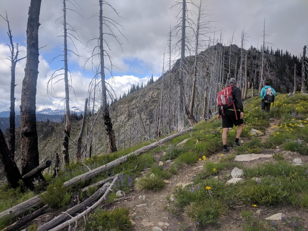
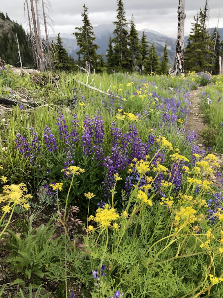
Green trees give way to a large burn, with vibrant sprays of wildflowers blossoming in a forest of charred ghost trees. I was amazed at the variety of wildflowers on display, a riot of color in an otherwise desolate landscape.

A study in contrasts: the ghosts of burned trees and brilliant wildflowers.
Photo credit: Seth Wolpin

Rising above tree line, we could see the Cle Elum River valley unfold below, with Cle Elum Lake rippling in the distance, ringed by peaks.

Cle Elum Lake in the distance.
Photo credit: Seth Wolpin
Cle Elum River valley, with Cle Elum Lake beyond.
Quizzing Rich after my evergreen tree identification tutorial.
Photo credit: Seth Wolpin

Traipsing through a meadow of yet more wildflowers, we reached a windbreak at the false summit. The site of an old lookout tower, we took advantage of the windbreak’s protection from the wind that grew steadily, peeking our heads up for views in all directions. We agreed it would be a most excellent campsite to keep in mind for a future outing. We were there for the summit, though, so after a snack we headed onwards and upwards.

The wind break, with the mountains of the Teanaway Country in the background. I’m pointing something out and explaining it to Rich, it seems.
Photo credit: Seth Wolpin
Definitely smiling here.
Photo credit: Seth Wolpin
Nice marmot.
Photo credit: Rich White

The trail became even more fun as we scrambled up to the peak. It was nothing sketchy but exciting enough to keep us on our toes.

Now that’s what I’m talking about!
Scrambling got a little spicy, but not scary.
Photo credit: Rich White

The summit offered more grand Cascades views. We visually scouted possible routes to the lakes down below, dreaming up a big adventure for another day.

For future reference…
Summit contemplations.

On the way back down, we scurried up a little rise and named it Friendship Peak in honor of our outing. We went off trail down behind it to scope out other potential camping spots, finding a nice one on a ledge overlooking the river valley below and Jolly and Sasse Mountains in the distance.

Despite tired legs, we picked up the pace on the descent to make quick work of the switchbacks. Rich was still recovering from surgery, so Seth and I waited for him below at the confluence of the Cle Elum and Waptus Rivers. It’s incredible to see rivers rushing like mad, gushing over boulders and shooting through narrow chasms of rock. We typically encounter the wider, tamer versions of these rivers, so it was fun to see their youthful emergence from the mountains.

The confluence of the Cle Elum (left) and Waptus (right) Rivers.

Rich arrived as the rain began, so we piled into the truck, happy for the time together on what will remain one of my favorite climbs of this 40 for 40 endeavor.

Peak 14: Summit Lake Peak

Peak 14: Summit Lake Peak

Elevation: 5800’

Total Mileage: 6.9

Total Elevation Gain: 1505’

Date: 13 June 2019

Summit Lake, and its namesake peak, was my first real hiking adventure after moving to Washington, so it was fun to revisit it after having made the acquaintance of so many other peaks and alpine lakes. On that first hike, in my first spring living in the Pacific Northwest, I marveled at the wild beauty just beyond my doorstep. I’d never taken a hike quite like that before, and when the summit view revealed a jaw-dropping mountain panorama complete with Tahoma as a backdrop, it just floored me. It felt like you could just reach out and touch the glaciers that flank the volcano. The constant smile plastered on my face made my cheeks begin to ache. In that moment, I decided that I wanted to bring every out-of-town visitor here so that I could share this wonderful place with my flatlander family and friends.

It took a while, but I finally made it back to Summit Lake Peak, with a friend and colleague in tow. The forest road to the trailhead was as potholed as remembered, but the trail did not disappoint. We lucked into another gorgeous June day as we started up through the forest into the Clearwater Wilderness. The trail winds its way steadily uphill, then forks at a juncture with the trail to Bearhead Mountain. Time didn’t allow for the tagging of two peaks, but I have grand plans to come back for a wild Bearhead Bushwhack Loop that entails a ramble through the Clearwater Wilderness and a scramble up something called The Rooster Comb. Stay tuned for that report!

Two out of the million glacier lilies we saw.

The glacier lilies were out in full splendor as we neared the snow line. We brought spikes for the occasion but held off for a while. The snow made it tough to follow the trail at times, so I was glad to have the GPX tracks. It’s funny to think back to my first excursion here, which turned into an off-trail adventure. Coming down from the summit in the snow, we lost the trail and just tried to head toward the lake. A friend had a Map My Hike app, so she left breadcrumbs on that to help us try to get back on trail. It was all a little thrilling and a little scary to feel like we were wandering around off trail in heavy spring snow. Looking back, I shake my head at that less experienced self, with no map, no compass, nor GPX route downloaded along with the digital map. This time around, Ingrid and I did wander a bit, but I was able to get us back on route quickly.

Peek-a-boo!

The lake itself is of that alpine lake blue, dark and deep in the center, ringed by aquamarine. A worthy destination in itself, but we were there for the summit views. About this time we opted for the spikes, as the snow was a bit more tricky as we ascended. The trail wraps around the lake and offers glimpses of mountains in all directions along the way.

Summit Lake, so pretty.
Looking down at Summit Lake on the way to the summit. Bearhead Mountain and Tahoma in the distance.

The final push was quite steep and snowy; one of those things you’re much happier going up and kinda dread coming back down. Happily, the summit was the showstopper of memory. It’s wonderful that, even after summitting so many gorgeous peaks, Summit Lake Peak wasn’t diminished; it stands up to memory and holds its own in the Cascades. Like the geek that I am, I pointed out all the big peaks in sight. All the mountains were out. We could see the Olympics Range to the west, Mount Baker and Glacier Peak to the north, as well as The Stewart Range to the east. Of course, to the south, was the great Tahoma, with Little Tahoma at its side. From what we could tell, Bearhead seemed to have an even more enviable vantage point.

In my happy place, on the summit.
Photo credit: Ingrid W.

We lingered for some time on the summit, eating lunch, making plans for more outdoor adventures, and basking in the warm rays of sun like two lazy cats. It was tough to pull ourselves away, but eventually we meandered back down the mountain.

Don’t worry; I was very careful when climbing down to get this shot.

Things went awry on the drive out. Despite my cautious speed and great care, I ended up with a flat tire. Fortunately, I had some Fix-a-Flat in the trunk, and we limped back to Tacoma.

Three cheers for Fix-a-Flat! Man, that tire looks very sad.
Photo credit: Ingrid W.

I’ll spare you the details here, but suffice it to say that the rest of the day turned into a nightmare when the garage that I have loyally touted and referred others to for years, Titus Will Service and Tire, blamed me for the flat and said I would need to buy 4 new tires. I had never had such a despicable interaction with any customer-service business; it was so bad that Ingrid had me go sit in the car while she gave the staff a stern talking to. If you want the details, I’m happy to explain everything that happened and why I will never go there again. I hate to taint my blog post with this, and I’m not typically vindictive or critical; it just goes to show how awful they were.

Peak 13: Little Bandera

Peak 13: Little Bandera

Elevation: 5157’

Total Mileage: 9.2 miles

Total Elevation Gain: 3213’

Date: 2 June 2019

When my dear friends, Kara and Joey, told me that they would be passing through Tacoma for a visit, I jumped on the opportunity to share the mountains with them. I’d been longing for a chance to take friends from the Midwest out to explore my new home, and I couldn’t have found two better people to venture into the wild with. Bandera was my top choice; it doesn’t have the crowds of more popular peaks in the Issy Alps, and it feels like a real mountain adventure. It was my first hike of that nature, so it seemed like a perfect fit for the occasion. I tossed out this option with a brief description, but, knowing my tendency to underestimate how challenging a hike might be for folks who don’t do these sorts of things on the regular, I added Rattlesnake Ledges as a less rugged route that still offered great views. I loved Kara’s simple reply: “We want to do the longer hike.”

The best friends are those you can go years without seeing, and then just pick right up where you left off. We burned the midnight oil, catching up over vegan cupcakes and local IPAs. Unable to ignore our yawns any longer, we turned in and rested up for our big adventure in the morning.

We were treated to a shorts-and-t-shirts-day of sunshine and blue skies, which June doesn’t always grant us. The Ira Spring Trail gives peek-a-boo views of McClellan Butte and other easy-to-identify peaks along the I-90 corridor.

Peek-a-boo view of McClellan Butte.

The trail is rather unassuming until it splits to go down to Mason Lake, or up to Bandera. Here, it gets steep, quick. Vertigo nagged at Joey, and I completely understood the challenge that posed. I’d had the same experience when I first climbed this route a couple of summers earlier. The WTA website notes that in this section, you gain one vertical foot for every two feet of trail. While there are some nice boulders to offer balance, there’s also a lot of loose, sandy rock that can be slick. Worrying that I had overcommitted us, I offered to turn back. Playfully alluding to our earlier discussion about Everest, Kara replied, “I have summit fever, I can’t stop now!” There’s no arguing with someone suffering from summit fever, so upward we went.

Gorgeous day to climb a mountain. Here, you can see Mount Defiance and Putrid Pete Peak , with my favorite ridge to traverse between them.

We arrived at the west summit, also known as Little Bandera. Technically a false summit, most hikers call it good here. We stopped to admire the views, and I pointed out some peaks by name, Tahoma being the most dramatic in view. It was fun to see Klickitat poking up to the southeast and to know I’d been standing on top of it not long ago.

Little Bandera summit views.
Looking down at Mason Lake, with Defiance and PPP beyond.
Summit smiles, with Tahoma in background.

Hopeful for the true summit, we scrambled a bit to the east. From what I understand, it takes some work to get there, and there’s not the same clear view that Little Bandera provides. I suggested that we head back to west summit and claim a nice spot for a summit beer and lunch. You don’t find many better picnic spots than this. After lingering for a while, we made our way back down the steep slope and through the meadows of bear grass.

Making our descent.
Wildflowers, mountains, volcanoes, and good friends: what more could you ask for?

While this might have been more like Type 2 fun for one member of our party, overall, I think that my friends enjoyed our adventure. I beamed with pride at the mountains that rise out of my backyard and was joyful to be able to share them with Midwestern friends. Of course, no Cascade adventure is complete without some Hurry Curry, so we capped the day at Aardvark and reflected on the highlights of the day. You really can’t ask for more.

Peak 12: Klickitat

Peak 12: Klickitat (Mt. Adams/ South Climb)

Elevation: 12,276’

Total Mileage: 9-12 miles

Total Elevation Gain: 6901’

Date: May 26, 2019

This was to be my first serious volcano ascent, and a good primer for Tahoma. While Loowit is a volcano climb, it’s pretty straightforward, and an ice axe and traction weren’t necessary. The South Climb up Klickitat isn’t technical, but it is significantly more challenging than Loowit. It would be the highest I’d ever been by my own power, too.

Happy to have had the comfort of the Westie for a good night’s sleep at the trailhead, we awoke early to start up the mountain while the snow-blanketed ground was still firm. While many climbers opt to camp at the Lunch Counter to break up the climb and to avoid ascending too quickly, we opted for a car-to-car summit. The trail wound up through the woods and soon enough we were above tree line. Seth, Jen, and Harrison were going to skin up and ski down; I was on snowshoes and planned to glissade down, having read so much about the epic Adams glissade chute. Just wait to hear how that all turned out.

Skinning up.
Easy going down low. PC: Seth Wolpin
Climbing to the Lunch Counter
Going up!
PC: Seth Wolpin

As the sun rose, we could see St. Helens to the west. It was surreal to think that just a couple of weeks ago, I had been standing on the flank of that volcano, looking over at the one I was now climbing. It was, initially, a beautiful morning, albeit a bit cloudy.

Loowit, framed by evergreens.

As we lumbered up the side of the mountain, though, the weather turned, as mountain weather is wont to do. The temperature dropped and the precipitation commenced. By the time we reached the Lunch Counter, my hands and toes were painfully cold, and my rain gear was starting to soak through. The wind picked up, and the adventure had turned into a true slog. We had some discussion about how to proceed. I was so wet and cold that if someone had said “Let’s bail,” I probably wouldn’t have protested. You know it’s bad if there’s even a whisper of quitting in my mind. Harrison suggested that we might be able to get above the weather, though so, hopeful, we agreed to keep at it a little longer.

Sure enough, we soon found ourselves above the bad weather, and blinding snow turned to brilliant sunshine. Crossing a wide plateau, we could see only one other climber going up the south face. Taking a look at this solo figure above, Harrison, in his calm and deadpan fashion suggested, “Anyone with a helmet should probably put it on now, with this yahoo above us. He might send something down.” The climber appeared to be having some trouble, so we quickly complied. This section was one of the most difficult parts of the climb. It was incredibly steep; much steeper than anything I had climbed. I dealt with the vertigo the only way I knew how, by keeping my head down and focused on the heels in front of me. Harrison blazed switchbacks up the face, and I followed, one foot in front of the other. When the going got simply too steep to keep my vertigo at bay, I opted to put on my crampons for some extra traction (but mostly for peace of mind.) Harrison and Jen put crampons on their skis. Seth had tried to go up closer to some rocks along the ridge, but that didn’t seem much easier, so he soon joined us.

Why does this not look as steep as it was?!
Photo credit: Seth Wolpin

My breath became shallow, and as the snow returned, the whiteness of the mountainside and the whiteness of the snowstorm merged, disorienting me and bringing on a wicked case of dizziness. It’s difficult to describe other than to say that I had trouble distinguishing between land and sky, and that sensation caused a panic that I worked hard to bottle down. It became easy to see how weather can effortlessly lead climbers astray. I also understood Chapter 42 of Moby-Dick, “The Whiteness of the Whale,” in an entirely new way. As Ishmael says, “It was the whiteness of the whale that above all things appalled me.”

Switchbacking up the slope, snow setting in.
Photo credit: Seth Wolpin

Harrison motioned me to the front to take a turn breaking trail. My rest step, French step, and will power to overcome fear all had ample practice time. It felt like we zigged and zagged for hours, left foot, right foot, repeat. It occurred to me for the first time that climbing an enormous stratovolcano can actually be a bit boring. There’s less taking in sweeping alpine views as you ramble along and more of just putting your head down and grinding out each step. Perhaps I wasn’t cut out to be a mountain climber after all, at least not in this fashion.

Breaking trail and practicing my rest step.
Photo credit: Seth Wolpin

We finally reached the next plateau below Pikers Peak. For about a millisecond, I considered running up to tag this false summit. Seeing how far off the true summit still stood, I quickly gave up that notion. As the air grew thinner, each movement took more effort. After a quick breather, I changed back to snowshoes, and we proceeded over toward the true summit. This entails a relatively long traverse before you reach the final pitch.

Taking a breather after that steep slope, at the foot of Piker’s Peak.

Oh, that final pitch was tough. I don’t know if it was as long or as steep as the section below Pikers Peak, but I was tired, my energy zapped by the altitude. With each step I thought to myself, “This is the highest I have ever been by my own power.” That was pretty incredible, and the thought helped to distract me from the vertigo. As before, I followed Harrison and Jen, head down, eyes fixed on their heels. I think what most bothered me was that I had left on the snowshoes instead of putting my crampons back on. The crampons had made me feel more secure. With the snowshoes, I felt like at any moment I could slip and hurtle down the slope and off a cliff. Breaking the nervous tension that I was clearly projecting, Harrison matter-of-factly said, “This is where I started carrying Torrie up.” In disbelief, I repeated, “You carried her up?” “Uh huh.” Well, I wasn’t about to have Harrison carry me up, so I gave a little snort and pushed myself upward.

Seth making a final push for the summit.
POV shot from Seth’s perspective, looking up at us on the summit.
Photo credit: Seth Wolpin

As the degree of the slope relaxed, my nerves eased up, and then, suddenly, we were on the summit. Jen and Harrison did a summit dance. I spun around for a 360-degree view of the Cascades unfolding around us. Tahoma stood to the north, Loowit to the west. Clouds were rolling in, so the views weren’t unobstructed, but the sky was clear enough in spots, and overall, it was what one would hope of a mountaintop view: a sea of jagged, snowy peaks rushing to the horizon and stunning you with their stoic elegance and grace. Here we were, perched high above this maze of mountains, nearly touching the sky. What a life we live.

A tad cloudy at the top.
Summit smiles. What a life!
Photo credit: Seth Wolpin
Yay, we did it!
Photo credit: Jen S.

I took a few brief minutes to soak in the experience, but the knowledge of what was yet to come did not allow for much peaceful reflection. I could hear Seth’s reminder in my mind: “Going up is optional; coming down is mandatory.” It was going to be a very long way down. It was going to be a very steep way down. And there was one very ugly cumulonimbus cloud galloping toward us.

Everyone else donned skis for the descent, while I opted for my crampons. Harrison had encouraged me to use the snowshoes, but I had myself too psyched out to trust them. I kicked myself for not putting on the anti-balling plates, as gobs of snow, as you might guess, balled up in my crampons, making them essentially useless. I had to stop and knock my ice axe against them every few steps. Oh, and the epic Mount Adams glissade chute of lore? Well, it apparently doesn’t show up until later in the season, as there was not a glissade chute in sight. As such, I slowly plunge stepped my way down the steep face. If I thought my vertigo was bad going up, it paled next to the descent, as I couldn’t just look down at the ground but, instead, had to look straight down the face. I tried, briefly, to glissade, but with no established chute, I was just zipping all over the surface of the snow and had very little control over my direction. In that moment, I realized that the stakes were much higher on this mountain than in any other alpine situation I had ever found myself. Looking at the cliffs that flanked either side of the face, I understood that this was serious. This was not a Mickey Mouse volcano like St. Helens. There would be serious, if not fatal, consequences for glissading out of control, for not being able to self-arrest. That reality hit me with such force that it felt like a sucker punch to the gut. Confronting your fears is fun, said no one, ever.

As we traversed back to the plateau under Pikers Peaks, it was clear that I was going to be the weak link. Everyone else on skies, they were able to zoom down in no time. We stopped to assess the situation at the top of that final steep face and melt some snow for water. Jen and Harrison decided that they wanted to ski out fast. Seth, of course, would stay with me, skiing a bit then waiting for me to catch up. Since we would be out later than them, Harrison gave us his jetboil so that we could melt more snow, if needed. You could feel our sense of dread as Harrison and Jen slipped out of sight. It felt unsafe to break up the team, but we understood their desire to get off the mountain. For me and Seth, we had no choice but to settle into what was going to be a long, slow descent.

One last break before splitting up.
Photo credit: Seth Wolpin

Coming down that last steep face was as bad as I had expected, but by that point I was motivated to push hard to get down as quickly as possible, preferably not by headlamp. Seth was saintly in his patience. He never skied too far ahead that we lost sight of each other. I plunge stepped like a maniac until the slope leveled out, and then I ran. I guess you could call it a run. The spots of sun had warmed the ground enough that it was more of a shuffle from posthole to posthole, but I was doing a fairly good job of keeping up with Seth.

I’m coming!
Photo credit: Seth Wolpin
I am a tiny spec on this great white face of a mountain.
Photo credit: Seth Wolpin
Oh, the price we pay for a cool photo. Not having fun here.
Photo credit, Seth Wolpin
Jogging punctuated by postholing.
Photo credit: Seth Wolpin
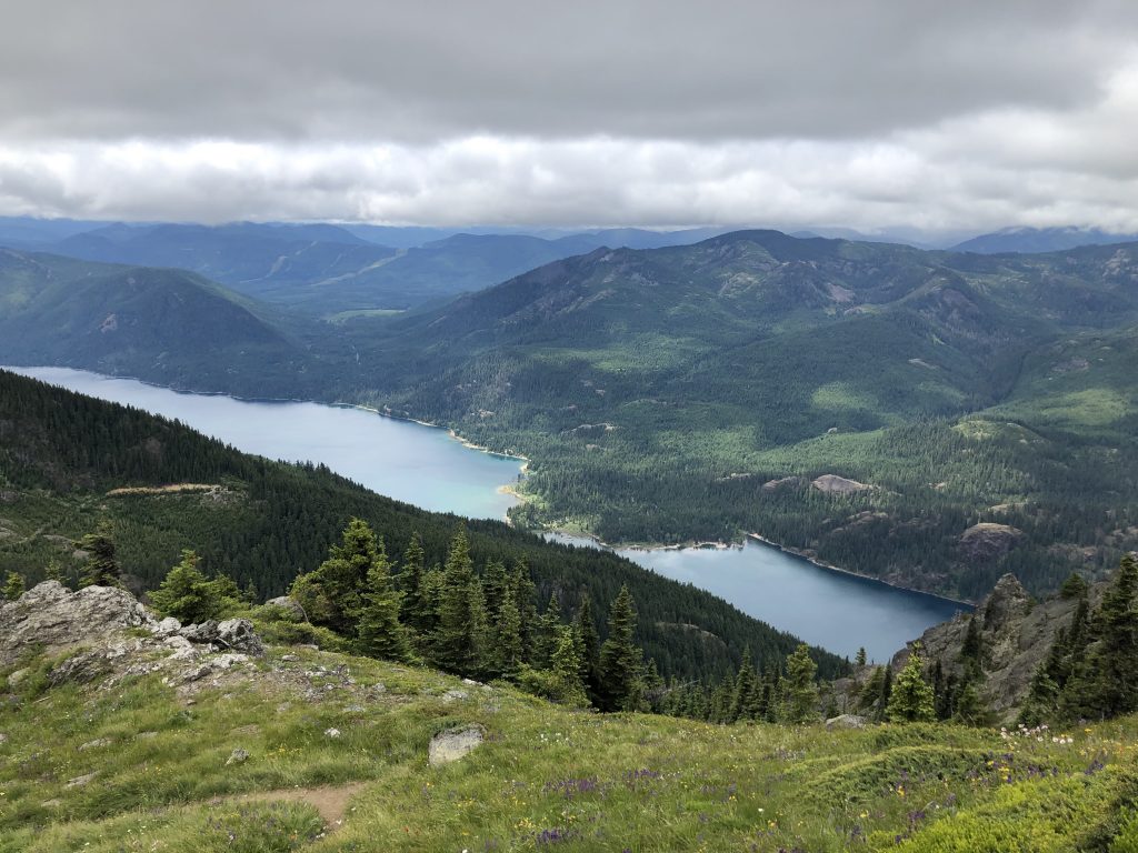
Near the tree line, we tracked too far to the north and got off trail. I caught our mistake quickly, but daylight was in short supply, and it only dampened our already sinking morale. I was able to navigate us back to the trail, and shortly after that, the snow subsided into patches. In the dusky light, we agreed to take a break from Type 2 fun. I admitted that I found the climb to be tedious and questioned whether I wanted to do stuff like this. I like being up high, running along ridges and taking in big views, but the rest stepping up the snowy face of a volcano felt, largely, like a slog. We discussed these ideas all the way back to the Westie, which was waiting there to provide warm clothes, a hot meal, and a comfy bed. We hadn’t planned to spend another night there, but in the late spring twilight, exhausted and spent, we were happy for our little van home and the comfort it gave after a tough day.

I realize that this sounds more of complaint than of joy, but it is an honest assessment of the experience. Yes, I am grateful to have done this climb, and I did enjoy quite a lot of it. There is something magnificent about standing so high above the world. There is something alluring in the risks of mountaineering; it is the simultaneous experience of terror and awe—the sublime—in its purest form. There is something satisfying about facing your fears head-on, fighting the urge to flee or scream or faint, and, instead, willing yourself to push through that which would otherwise hold you back. All of this, and more, I appreciated about this climb. I am eternally grateful for the privileged life I live that presents me with opportunities to test myself in the wild.

The experience also leaves me with some valuable lessons learned. As is my habit, I minimized elements of the excursion. Seth and I should have been carrying a shelter, sleeping bag, and jetboil. We should have been more prepared to spend the night outside. We came pretty darn close to getting way off route on our return, and a night on the mountain was a real possibility. I learned that someone on snowshoes absolutely cannot keep up with skiers. While I had beaten Seth down St. Helens, there had been a bomber glissade chute there. Without one on Adams, I was dangerously slow. Not so much a lesson, but I felt like I passed my first altitude test. This was the highest I’d ever been, but I didn’t have any adverse effects from the altitude. Near the top, I moved more slowly, but that’s to be expected. I had a very slight headache, but I suspect that was more from dehydration than altitude. Overall, it was reassuring that I might be ok doing other high-altitude excursions in the future (such as Rainier in 2 months and Nepal in the near future.) While it might seem minor, I learned a painful lesson about chapstick: make sure that it contains sunblock. I faithfully reapplied sunblock to exposed skin and lip balm to lips throughout the day, but, alas, I learned the hard way that my lip balm did not have sunscreen in it. As a result, my lips bubbled and peeled, and I was a total freak show for a week after this. Finally, I learned that big mountain climbs might not be my thing. I was excited to give it a try, and I had no plans to bail on my upcoming Rainier expedition, but I found the one-foot-then-the-other monotony of the experience to be rather dull. As I said above, I like to be up high and get big views, but moving forward, I might seek out those experiences while traversing a ridge instead of rest-stepping up the snowy side of an enormous volcano mountain. That sentiment seems to encapsulate my approach to embarking into the natural world. I’m keen to have new and varied adventures, but I’m also prepared to discontinue pursuits that don’t light my fire and, instead, will gravitate toward those that make my flame burn bright.

Peak 11: Green Mountain (plus Dirty Turtle 25k Trip Report)

Peak 11: Green Mountain (Kitsap Peninsula)

Elevation: 1639’

Total Mileage: 15.5

Total Elevation Gain: 3228’

Date: May 18, 2019

I have lost track of how many times I’ve summited Green Mountain this year; definitely 4, possibly 5, and using at least 3 distinct routes. On this particular occasion, it was part of the Dirty Turtle 25k course. Oh how it pains me to write the words 25k course! I had run, and won, the inaugural Dirty Turtle 50k (setting the course record, which still stands today by one hour), and I lost the second year by about one minute (thanks to me running a dumb race and blowing up after leading for 26 miles.) The race has a soft spot in my heart, and I love the old school vibe and fun crowd it attracts; RD Gretchen Ta is just a cool lady who knows how to put on a great event. This year, on coach’s orders, I was only running the 25k, and I wouldn’t be racing. I was on the road to recovery and agreed to take it easy and treat this as a training run. Try telling that to my ego.

The race had a downhill start, and I couldn’t help myself. I bolted from the start, dragging my friend Jen along at an insane pace. Reason prevailed as the decline leveled out, and I positioned Jen in front of me, telling her not to let me pass and to keep the pace casual. Eventually, I settled down and eased into a good training pace as we chatted about this and that. Instead of a race, I accepted it as a fun day in the woods with a friend. And it was!  

Coming out too hot.
Photo credit: Jayme Helgeson

The race takes you up to the summit of Green Mountain, by way of Turtle Rock, which is a fun Class 2 scramble. Each year, you can count on a young cowboy wearing a hat and Daisy Dukes, plus a flannel top with the sleeves cut out, to be waiting to greet you at the top of Turtle Rock, offering Fireball or pickles. I chose pickles.

Beginning the scramble up Turtle Rock.
Photo credit: Jayme Helgeson

As you make your way on a narrow trail that feels more boot track than single track, you wind over toward the summit of Green Mountain. We had to veer slightly off course to tag the true summit, but, hey, I wasn’t racing, so why not! On a clear day, you can see the Salish Sea and even Seattle in the distance. I’m always surprised by how far north we’ve come up the Kitsap Peninsula to get here. We took photographic evidence of our summit, then carried on.

I can’t seem to find the summit photo, so you’ll have to accept this action shot as a substitute.
Photo credit: Jesse Dooghan

As we neared the finish line, I slowed my pace to let Jen clearly finish ahead of me. It was my way of letting go of competitiveness and acknowledging that she helped keep me from going too hard. She took fourth place, and I was fifth. (Incidentally, I registered for the 2020 Dirty Turtle 50k this very morning, and I am going to train to win it this next go round.) All in all, while this might not be the most glamorous peak on the list, the Dirty Turtle race, and the people associated with it, makes it something I look forward to each year. I enjoy the trails and atmosphere, and it’s someplace I think of fondly.

Peak 10: Loowit

Peak 10: Loowit (Mount St. Helens)

Elevation: 8364’

Total Mileage: ~12 mi

Total Elevation Gain: 5620’

May 11, 2019

Wanting to share in my peak challenge in some way, my Mom and Stepdad came out from Cincinnati to celebrate Mother’s Day and Peak 10. While they wouldn’t be able to join me and Seth for the climb, they would be able to check out the various visitor’s centers that showcase exhibits about, and great views of, the volcano. The quirky Kalama McMenamins served as our basecamp for two nights.

View of the Columbia River from the Kalama McMenamins.
Photo credit: Seth Wolpin

Seth and I arrived at the Climber’s Bivouac trailhead in the early morning and were on the trail shortly after 6:00 a.m. There’s a Mother’s Day tradition of people climbing in dresses, as a tribute to mountaineer Kathy Phibbs. (Here’s a nice write up about her and the birth of this tradition.) We saw many climbers who were in the spirit of things even on this Mother’s Day Eve. I think my favorite was the burly mountaineering type sporting a slinky leopard print nightie.

This was my second Mother’s Day weekend summit of Loowit. It’s perfect because the weather was gorgeous both years, the atmosphere was festive, and the snow is much easier to trek up than the loose scree of the summer route. After winding through the forest, you soon cross the Loowit trail, which circumnavigates the mountain (trip report on that adventure forthcoming!) At this point, you leave the forest and start up the ridge, the slope rising steeper and steeper. I was coming back from time off due to medical issues, so I wasn’t at my peak fitness. As such, it was somewhat slow going. (Amazingly, the year prior, I did this climb the day after racing a tough 50k, went 2 miles off route, and still managed to complete the climb faster than this year.)

Setting out. The summit doesn’t look that far away, does it?

As we made our way up and up, other volcanoes soon made an appearance. To the south, the distinctive form of Wy’east (Mt. Hood) rose above the fog. Klickitat (Mt. Adams) eyed us from the east. In two weeks, we would be looking back at Loowit from its summit. As we periodically paused, we also remarked on the vast Cascade range, noting ridges we’d like to traverse or valleys we’d like to disappear into and live as hermits, undisturbed in the woods.

Taking a break to take in the views. You can faintly see Wy’east (Mt. Hood) in the distance, toward the right side of the frame.
Up we go! You can see men in dresses above.

While it wasn’t necessary, I opted to wear crampons on the upper slope, just for the practice. Stopping at one point to look back, and down, behind me, I couldn’t help but laugh at how far I’d come in a year. Last year, I had to keep my head down and face forward, lest I faint. I was working through some serious fears of exposure and heights, and my heart pounded wildly for much of that ascent. Now, my heartbeat was elevated only by the exertion and my lack of fitness; the height and exposure didn’t faze me. That felt really good to know that with time and experience, I could overcome my fears.

Pshaw. This slope ain’t no thang. Klickitat (Mt. Adams) beckons in the distance.
Photo credit: Seth Wolpin
There was a party raging at the summit. Climbers in dresses were all smiles and laughter, the requisite joie de vivre in honor of Kathy Phibbs. Careful not to tempt the cornice, we edged up to the crater rim and peered into the heart of the volcano. Vaporous steam trailed up into the air. Beyond the rim, you take in views of the blast zone and Spirit Lake. It’s truly incredible to see the planet’s power to destroy and rebuild itself captured in this portrait from the summit. To the north, snowy Tahoma loomed large. I smiled at the thought that, before long, I would be looking back at Loowit from there as well.

Joie de vivre at the summit, in honor of Kathy Phibbs. Plus, Klickitat photobomb.
Photo credit: Seth Wolpin

We found a nice spot a short distance away from the party to eat lunch and marvel at the views. How fortunate we are, to be munching sandwiches on the top of a volcano on a sunny day with views forever. Sometimes, I simply can’t believe this is my life. It was also fun to know that my Mom and Stepdad were down below, looking up at the summit and imagining us there. We sent them a wave from the top.

Summit view, looking down into the crater, with the blast zone beyond. Spirit Lake and Tahoma in the background.
My Mom took this photo from the visitor’s center while we were on the summit. Pretty neat!
Photo credit: Cindy Williams
Summit smooch
Photo credit: Seth Wolpin

The descent of Loowit is the absolute best part, because you have the option to ski or glissade, and drop 5000+ feet in no time. This would be Seth’s first volcano ski descent. My skiing skills are still shaky at best, so I opted to glissade. We would meet back at the car with stories to share. It was fun to watch Seth start off, enormous grin on his face. He disappeared over the edge of the slope onto the skier’s route, and I made my way to the first glissade chute.

“That looks like a good place to ski down.”

Last year, I was incredibly anxious sitting down for my first glissade. We had watched people sliding down wildly out of control and screaming; my friend Jen assured me they were just being idiots, but it freaked me out. Taking that first push off the summit was terrifying—for about 5 seconds—and then, it was pure bliss! So much so, that we glissaded two miles off route because we were so caught up in the fun. This year, I wasn’t nervous at all, and I also would be mindful of staying on route. [For the record, while Jen and I veered off route in 2018, we were entirely prepared for such a contingency. When I caught our mistake, we had the equipment necessary to determine our location; we had the 10 essentials; and we were prepared to be out after dark—or be out overnight—if things went south. Much to my embarrassment, we also had Seth tracking us via my inReach, and he sent a message asking if we knew we were off route. Yes. We navigated back to the route and had no problems.]

How to describe the joy of glissading? Imagine the fun of ripping down a tall slide as a child; your body moving quickly and easily, the wind through your hair and in your ears, the sensation of being slightly out of control but also being thrilled by that. Now imagine that you’re zipping down the side of a snowy stratovolcano instead. Many “yeehaws!” escaped my lips, almost involuntarily. I find that it’s most fun when you build up a lot of speed and start to have a faint sense of losing control. Most likely, you’re in a good chute that keeps you on course. There’s the occasional rock to worry about (something hit my tailbone and bruised me pretty badly), but you’re not going to fly off the mountain. I had my ice axe ready as a brake, but I really only used it to avoid other people, or to slow down to check for rocks.

Heading way off route in 2018, but having a blast.
Video credit: Jen Schneider

The drawback to glissading is that it’s over too quickly. You reach a point where there may be a chute or two, but the angle isn’t really steep enough to slide you down, and it becomes this pathetic attempt to scoot yourself along before you must finally admit that it’s time to hike. Fearing that Seth would have been waiting for me for an hour after his speedy ski descent, I kicked into a fast trot along the trail.

And then came the moment that completely derailed my experience. As I jogged past hikers, some of whom were not properly dressed or equipped to be attempting a volcano summit, and others clearly making their way up very late in the day, a backcountry ranger stopped me and started an interrogation. “Are you out here alone? Does anyone know where you are? Are you doing ok? Do you need anything?” I was livid. If you did a lineup of everyone that was there, I was, hands down, the one who, on the outside, looked the most prepared for the occasion. A simple scan of my gear would have told you that I wasn’t new to this sort of thing. I was also confidently, and strongly, jogging down the trail while carrying all this gear (including my satellite beacon prominently visible on my shoulder strap), while others were literally off trail and bumbling about looking for the route (all within eyesight of these rangers.) How can anyone actually be alone on a mountain with 500 other people on the same exact route? But that’s beside the point—so what if I was not with a companion?

Perhaps you’re thinking to yourself that I’m overreacting here, but this is a recurring problem that I—and many women—must deal with out in the natural world. The fact that I’m a woman, and alone, sends out a red flag to men that I might need help. You might be thinking that this guy was simply doing his job and politely checking in. Honestly, that perspective is insulting. There were plenty of hikers there whom he could have singled out because they seemed unprepared or off route. Other women were in groups, though, protected by their male companions. I was an easy target to question because I was a solo female out in the woods.

This is not the first time a man has questioned me being out in the wild alone (see my trip report for Peak 2, for example), and it certainly won’t be the last. In fact, on last year’s summit of Loowit, a dude stopped me and Jen to tell us that we were starting too late and that we wouldn’t make the summit before dark. Jen just laughed it off. I said, “Not our first rodeo, dude” and kept walking, but I also fumed for the next hour about the situation. What was clear to us was that this guy wasn’t going to make it to the summit himself, so he had to ease his ego by mansplaining mountaineering to us, which he couched in genuine concern (this is essentially the same thing that happened at Grouse Mountain.) What gets presented as simple concern is, in fact, patronizing and sexist.

Let’s face it, if I had been a dude, there’s no way that ranger would have stopped me to interrogate my credentials for being there alone. This ranger was reinforcing a cultural bias, whether it’s unconscious or explicit, that women are incapable of solo endeavors in the wild.

“Yes alone, and I’m fine. Someone knows where I am.”

He smiled and sent me on my way. My blood was boiling.

Like Loowit, I was a volcano preparing to explode (writing that reminds me of Ursula Le Guin’s excellent essay, “A Very Warm Mountain,” in which she links the eruption of St. Helens with feminism.) I’m not good at confrontation, though, and I’m not good at finding the right words in the moment. As I ran down the trail, I gave the ranger a piece of my mind, working out the details of what I should have said. I vowed in that moment that the next time anyone questions me about being out alone, that I would let him have it. Of course, snapping at one person isn’t going to change a broader cultural issue. Seth and I spent a lot of time talking about this, and we concluded that it’s high time that I just write my damn book and integrate this topic into the narrative.

When I started typing this morning, I thought it would be a brief trek down memory lane of a fun climb. I must have repressed the ranger incident, because I actually didn’t think about it until I got to that juncture in the story. It’s so upsetting, and something that I have to deal with more than you’d think, that I must have buried this incident as a coping mechanism. The good news is that I’ll be working on a book about women and wilderness during my sabbatical. Here’s hoping that’s both a therapeutic way to work through these emotions as well as a productive way to engage an audience in a broader conversation about a very real issue.

After fuming down the trail for a couple of miles, I finally reached the car. Much to my surprise, Seth wasn’t there. I couldn’t believe it. It seemed impossible that I had descended faster than him. About 30 minutes later, he rolled in with tales of his own adventure. He’d had fun but perhaps found his way onto a more difficult route than others skied. Despite that, he had a blast and was excited to ski Klickitat next.

We returned to the lodge for naps and a celebratory dinner, exchanging stories with my parents. Exhausted, we were asleep before our heads hit the pillows, and I dreamed of white-capped volcanoes and of flying through glittering snow.

Peak 9: Mt. Ellinor

Peak 9: Mt. Ellinor

Elevation: 5944’

Total Mileage: 5-ish

Total Gain: 2361’

Date: May 4 & 5, 2019

Mount Ellinor stands out as one of my favorite peaks from this 40 for 40 adventure, and it’s easily in my top three greatest campsites of all time. There are few things more exhilarating than waking up on top of a snow-capped summit to watch the sunrise over two mountain ranges. It also felt like a celebratory occasion, as the night before Seth and I decided to move in together, taking a big step forward in our relationship.

I had climbed Ellinor a few years earlier, but on the summer route. I’d heard about the sweeping views of the Olympics and Cascades Ranges, and the steep climb required to earn them. The mountain was socked in that day, so no views, but it still came with the steep climb. I nevertheless enjoyed the experience and was glad to go back. This time, we would be taking the winter route.

We parked at the upper lot, which was quite full. A guy in a flannel shirt and jeans headed out in front of us, then came back saying that he thought he heard a cougar. (There was a note at the trailhead about being aware that you’re in cougar country.) He wanted to walk up with us, but after I assured him that what we heard was, in fact, a bird, he went ahead to catch up to his friends. I understood his anxiety, and there was a time when I might have made the same mistake. I believe that I was tactful enough not to say out loud that he wouldn’t hear a cougar if one was stalking him. I noticed that this guy had no pack or layers. He carried a water bottle and nothing else. For me, it’s impossible to imagine going into the wild so unprepared. You have to tread a fine line, though, between trying to educate people and not policing the mountains. I have no idea how to address the issue of hikers venturing into wild places without basic essentials like food and layers, but it strikes me as important to reach beginners with important information about how to access the natural world safely and responsibly. I see hikers like this one all too often, but I haven’t come to a satisfactory solution for how to engage with them in a helpful manner. What are your thoughts on this? If you’re new to outdoor adventures, check out this helpful overview that can get you out on the trails while keeping your own safety and well being in mind.

Breaking out above treeline and onto the snowy slope.
Photo credit: Seth Wolpin

The trail winds through an evergreen forest before opening up onto a steep, snowy slope lined by forest on each side. We brought along pickets, rope, ice axes, crampons, and other climbing equipment in order to use this ascent as an opportunity for mountaineering practice. Finding a nice, open area off the main trail, we roped up and worked on setting pickets, something that I’d not done before. This was a great place to learn and test out new skills, as the slope was quite steep, but there was no real danger of cascading off a cliff or into rocks. Next, Seth demonstrated self-arrest from a variety of angles and situations, and then it was my turn. I fared quite well with self-arrest in the standard positions, so Seth said it was time for him to (without notice) pull me backwards to simulate a rope teammate falling and pulling me backwards so that I could practice self-arrest in this scenario. The prospect, admittedly, scared me. While he had me on a belay and I wasn’t going to fall off the mountain if I couldn’t self-arrest, the idea of falling backwards and potentially hitting my head, even while wearing a helmet, was terrifying for me. I was slightly worried that I wouldn’t be able to properly self-arrest, but more so my fear stemmed from the trauma of my TBI and not wanting to hit my head again, ever.

My mountaineering school instructor showing me the ropes.

To help me work through that fear, I first kneeled down and then fell down backwards, sliding down the mountain head first and on my back. It was incredible how quickly I was able to use my ice axe to flip myself around and self-arrest. It felt instinctual and immediate, much to my surprise and delight. With that confidence boost, I stood up and fell backwards, with the same result. Out of excuses, it was time to let Seth pull me without notice. I absolutely hated this, but I understood the necessity. Each step was agonizing, tense with the anticipation of him jerking the rope and yanking me backwards at any moment. Because I was waiting for it, though, I had a split second to feel his pull; as such, I immediately flopped down on my belly and went into self-arrest before I could be pulled backwards. I joked that I had done what one should do by going down into position, but I had failed the test all the same. Being the perfectionist that I am, this bothered me the rest of the weekend, and I knew that I was going to have to retake that exam.

Self-arrest workshop over, we did some additional picket practice, this time with me leading, as we made our way to the summit. Hitting a notch that leads to the false summit, we laid the final round of pickets and then came off the rope to trek over to the last steep pitch up to the summit. It was late in the day and only a few parties remained. This time, the summit treated me to expansive views into the heart of the Olympics. I don’t know this range as well as I do the Cascades, but this panorama inspired me to get better acquainted with them soon.

Photo op before the final climb to the summit, with snowy Olympics Range as the backdrop.
At least I have all the gear in hand to look the part of a mountaineer!
View of summit from below. You can just make out another party up there.
Summit view, looking into the Olympics.

The bonus to this trip was that we were going to spend the night on the mountain. We briefly considered pitching camp on the summit, but there’s not a lot of room there, and we didn’t want to impede the experience of anyone coming up early for the sunrise. Glissading down to the plateau below the summit, we found a lovely spot off the trail, close to the cliffs overlooking the summer route. There was one other party camped below us, but we couldn’t see or hear them, so it felt much like having the mountaintop to ourselves. I think this photo about sums it up. I went to sleep giddy at the thought that I was sleeping on top of a mountain. It was a first for me, and my heart thrills at the thought of it as I write this more than six months later.

Stoked!!
Photo Credit: Seth Wolpin

An inversion enveloped the scene at sunrise. Ellinor’s neighbor, Mount Washington, peeked above the clouds, the jagged rock summit protruding from a blanket of snow. From the tent door, I could see the Brothers in the distance, along with other Olympics peaks whose names I do not know. Breathtaking. Coming out for a survey of the horizon, the volcanoes of the Cascades hovered above the clouds; St. Helens, Adams, Rainier, Baker, and Glacier all made an appearance before the clouds rose and curtained them.

View from inside the tent. This was the most incredible wake up surprise of my life.
Best campsite of the year, and one of the best ever. You can see Tahoma in the distance.
Reluctantly breaking camp.
Photo credit: Seth Wolpin
Quite the memorable sunrise, with Mt. Washington, The Brothers, and other Olympics peaks peeking above the clouds. Be still, my heart!

The descent would prove tricky, as the morning snow was rock hard ice. This meant no speedy glissade down the steep snow slope. Instead, we plunge-stepped as best we could in those conditions. Coming down through the notch was a little scary, as it’s quite steep, so I tossed on my crampons for a little extra purchase. The clouds broke, though, so the mountain treated us to clear morning views of Lake Cushman below. All too soon, we were back at the car, and our mountaintop adventure came to a close.

Descending a steep slope on frozen snow, with Lake Cushman below.
So steep! So frozen!
Photo credit: Seth Wolpin

This outing whet my appetite for sleeping on mountaintops. Sadly, I haven’t had the opportunity to do so again, as plans to bivy on Mount Catherine, and then Mount Aix, followed by DeRoux, and then later on Koppen all fell through due to weather (extreme wind; snow; heat; and snow, respectively.) While I have enjoyed countless beautiful backcountry campsites over the past two years, nothing has compared to being on Ellinor in terms of grandeur, novelty, and excitement. Come next summer, my goal will be to sleep on as many mountaintops as the weather will allow. Thanks to Seth for the mountaineering instruction and for sharing this experience with me. Looking forward to bivying on many more mountaintops together!

« Older posts

© 2024 Life Near the bone

Theme by Anders NorenUp ↑